Скачать
Import XYZ coordinate into GIS, Create DEM (Digital Elevation model) and extract and style contour
Автор: arjun.b
Загружено: 2023-03-03
Просмотров: 1862
Описание:
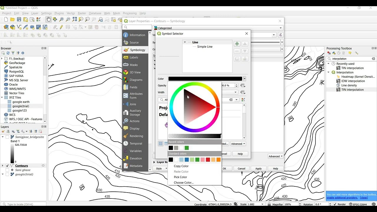
-Import XYZ coordinate from Total station data or survey data to QGIS.
-tin interpolation,
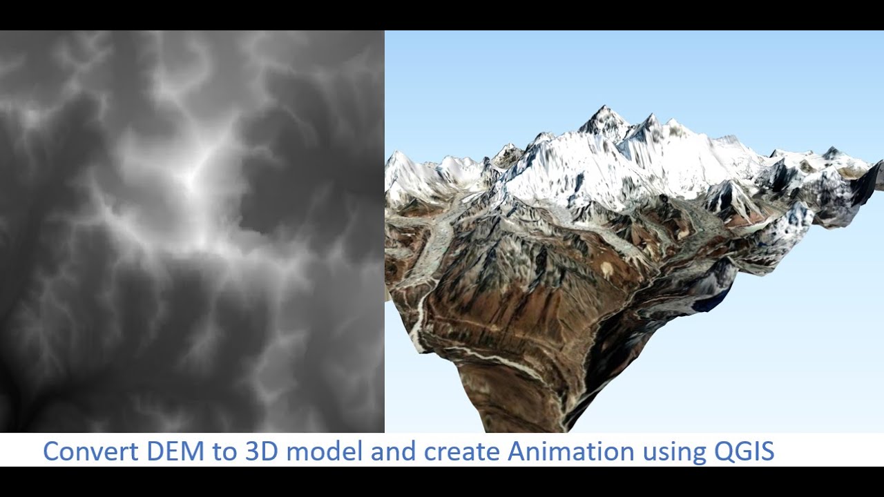
-Create Digital elevation model DEM from point cloud.
-Extract contour
-style contour,
-Separate contoru by major and minor contour and style based on type
-provide elevation label and style the labelling
-export contour from qgis to autocad
Не удается загрузить Youtube-плеер. Проверьте блокировку Youtube в вашей сети.
Повторяем попытку...
Повторяем попытку...
Доступные форматы для скачивания:
Скачать видео
-
Информация по загрузке:


![Как сжимаются изображения? [46 МБ ↘↘ 4,07 МБ] JPEG в деталях](https://imager.clipsaver.ru/Kv1Hiv3ox8I/max.jpg)


