Скачать
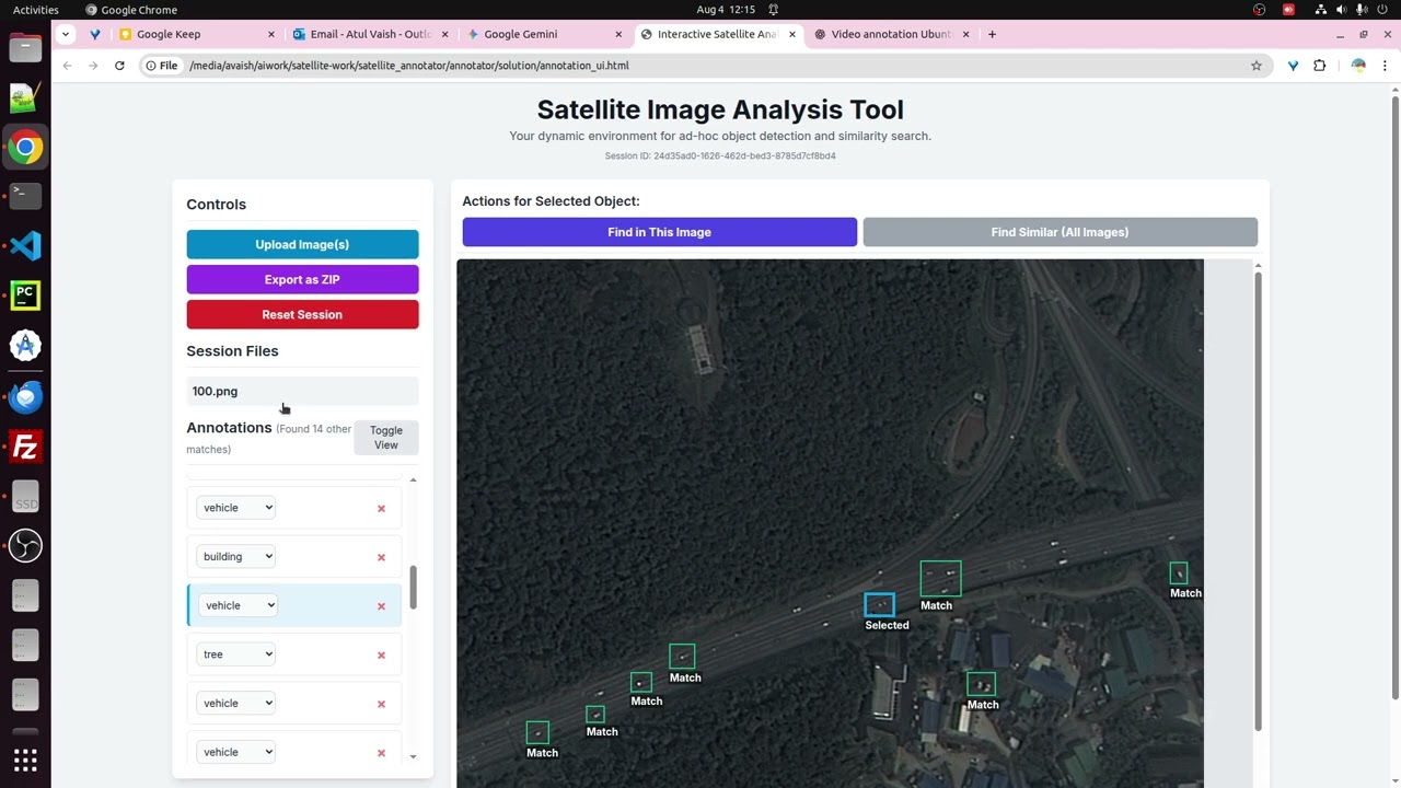
Satellite Image Analysis Tool
Автор: avsvar
Загружено: 2025-08-04
Просмотров: 27
Описание: Using this tool , single or multiple satellite images can be analysed to see what it has , where it has and how many it has..The annotated image and annotation data can be downloaded to prepare a remote sensing dataset for usage across drones, satellite and other flight methods to intelligent object detection.
Не удается загрузить Youtube-плеер. Проверьте блокировку Youtube в вашей сети.
Повторяем попытку...
Повторяем попытку...
Доступные форматы для скачивания:
Скачать видео
-
Информация по загрузке: