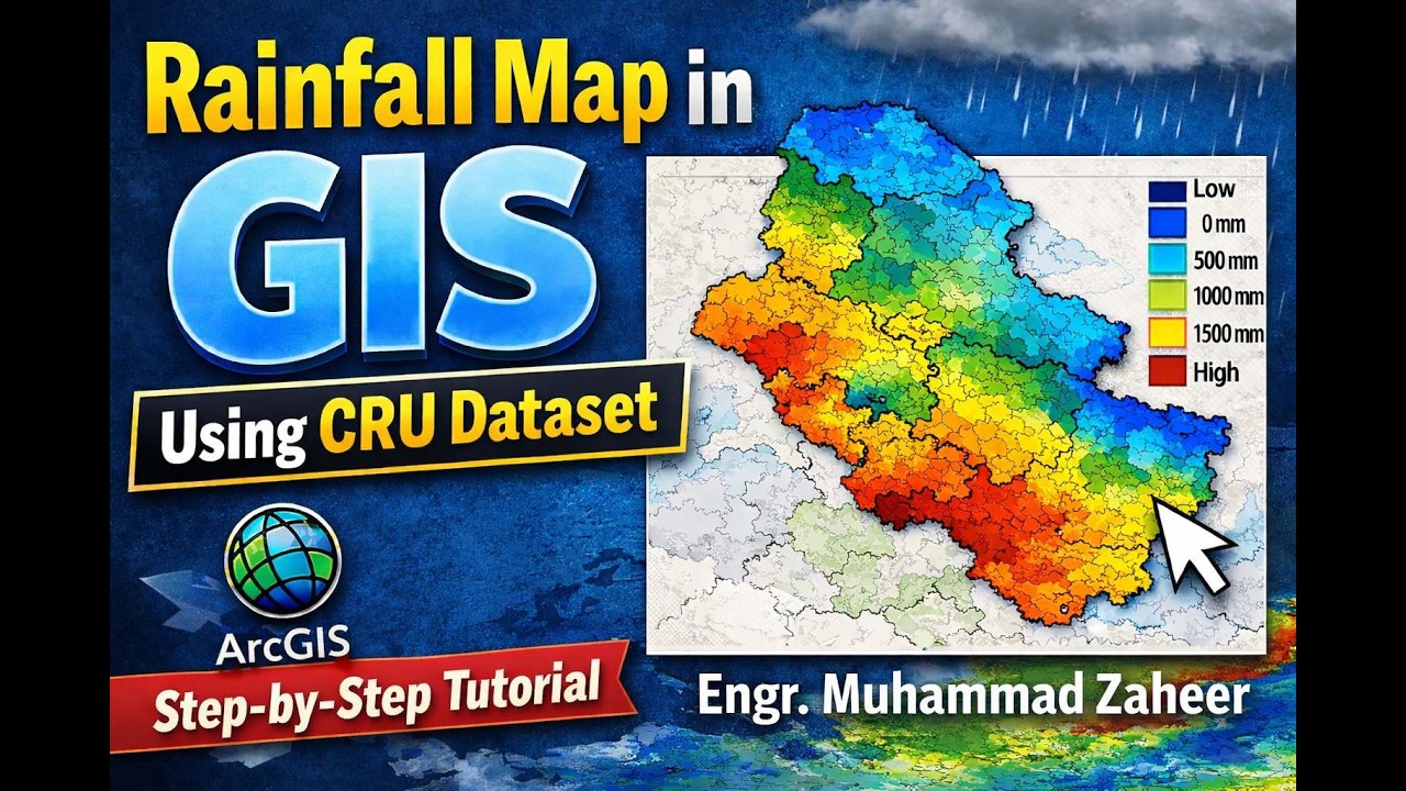
How to Create a Rainfall Map in GIS Using CRU Climate Dataset | Net CDF Files
Автор: Engr. Muhammad Zaheer, P.E
Загружено: 2026-02-04
Просмотров: 499
Описание:
In this detailed tutorial, you will learn how to create a rainfall map using GIS with the CRU (Climatic Research Unit) climate dataset. This step-by-step guide is designed for students, researchers, hydrologists, and GIS professionals who want to visualize rainfall patterns for watersheds, regions, or countries.
🌐 What You Will Learn in This Video:
How to download and access CRU climate data
Preparing and formatting climate data for GIS
Importing CRU dataset into ArcGIS or QGIS
Creating raster rainfall layers
Visualizing spatial distribution using color gradients
Performing basic analysis like mean annual rainfall, seasonal patterns, and hotspot identification
Повторяем попытку...
Доступные форматы для скачивания:
Скачать видео
-
Информация по загрузке: