Natural beauty of Azad Kashmir | Kohala Bridge to Muzaffarabad city | Travel to| 4KK Natural
Автор: 4KK NATURAL
Загружено: 2026-02-11
Просмотров: 109
Описание:
Kohola to Muzafer Abad travelling guide
Kohola bridge Azad Kashmir
Here’s a detailed travel guide for your route from Kohala Bridge in Azad Kashmir to the capital city of Azad Kashmir, Muzaffarabad. I’ve explained the entire trip step by step, including the route, travel conditions, time, distance, road tips, and what you can expect to see along the way.
Starting Point: Kohala Bridge
Kohala Bridge sits on the Jhelum River and marks a key gateway between Punjab and Azad Kashmir. It’s a well-known landmark where the E75 expressway from Islamabad connects into Kashmir’s road network. �
Wikipedia
Distance and Travel Time
If you take the most direct main road from Kohala Bridge to Muzaffarabad, the distance is around 36 to 40 kilometers by road. On average, this drive takes about 45 minutes to 1 hour in normal traffic. �
There are longer alternative routes (for example via Dhirkot or Murree) that take more time, but for most travelers the straight highway is the best option. �
Distances From +1
Distances From
Route Overview
Leave Kohala Bridge and follow the Kohala–Muzaffarabad road (Strategic Highway S-2) north. This is the main paved road maintained by the National Highway Authority and links directly with the route. �
Wikipedia
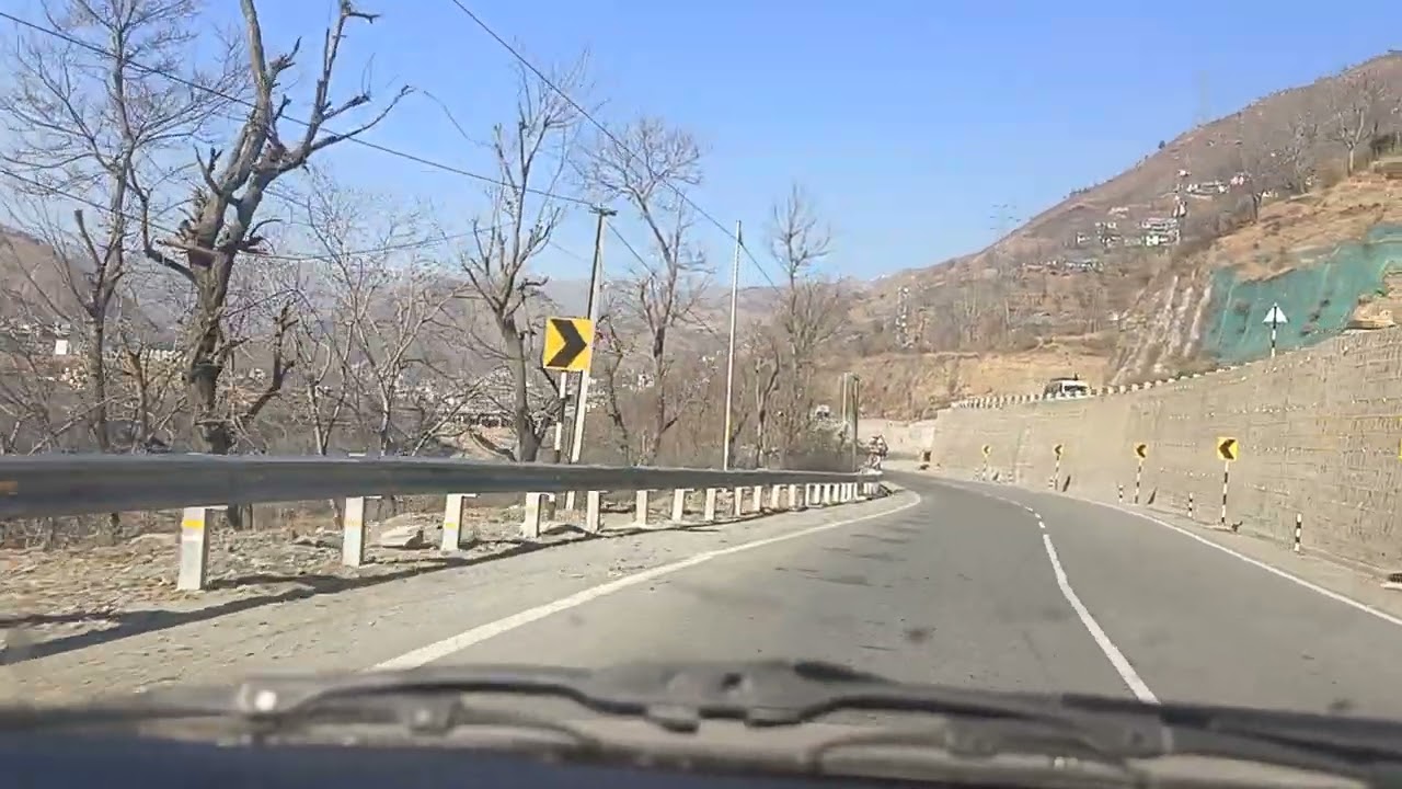
As you head north, the road follows the contours of the hills and gradually climbs toward Muzaffarabad. You’ll see a mix of small towns, agricultural land, and forested hillsides.
Approach Muzaffarabad from the south. The city is surrounded by mountains and lies at the confluence of the Jhelum and Neelum rivers.
Road Conditions
The highway between Kohala and Muzaffarabad is generally paved and suitable for cars, vans, and motorcycles. Depending on the season, you may encounter construction work, narrow sections, or landslides after heavy rain, like other hill roads in the region. Roads can also become busy during holidays. It’s a good idea to check local traffic updates before you travel. �
Reddit
What You’ll See on the Way
Hilly terrain with scenic views of valleys, forests, and distant mountains.
Villages and roadside shops where you can stop for chai or snacks.
Riverside views as you draw closer to Muzaffarabad.
Small bridges, streams, and local traffic, especially buses and trucks heading to and from Kashmir.
Arriving in Muzaffarabad
Muzaffarabad is nestled in a mountainous bowl at the meeting point of two rivers. Its layout is unique because the city spreads along narrow ridges and valleys. Once you arrive:
You’ll likely cross the Earthquake Memorial Bridge (Zulfiqar Ali Bhutto Bridge) over the Jhelum River to enter the central parts of Muzaffarabad. This is a modern cable-stayed bridge and one of the city’s key connections. �
Wikipedia
From here you can explore the main bazaar, government buildings, markets, and riverfront areas.
Practical Tips
Fuel: Fill up before leaving Kohala, especially if you’re on a motorcycle or small bike.
Safety: Keep basic tools and a phone charger with you. Roads in Kashmir are scenic but can be narrow in parts.
Weather: In rainy or winter months, check local conditions
before you go. It’s common for roadside slips or delays during heavy rain.
Kohala to muzaffarabad
by road | neelom valley
A bike Tour Kohala To Muzaffarabad
kohala Bridge To Sabri
Abshar
Azad Kashmir
kohala to muzaffarabad
kohala to dhirkot
kohala to bagh
kohala to 2 female version
kohala to nepali song
to kohala paga
kohala bridge today news
murree to kohala bridge
back to kohala
murree to kohala road
Повторяем попытку...

Доступные форматы для скачивания:
Скачать видео
-
Информация по загрузке:


![Bagong Silangan | Quiet Afternoon Scenes Beyond the Main Road [4K] 🇵🇭](https://imager.clipsaver.ru/1yykh37vdj0/max.jpg)