Head of La Paloma Submarine Canyon | SOI Divestream 843 - Part 2
Автор: Schmidt Ocean
Загружено: 2025-09-09
Просмотров: 21581
Описание:
Dive Description (Spanish):
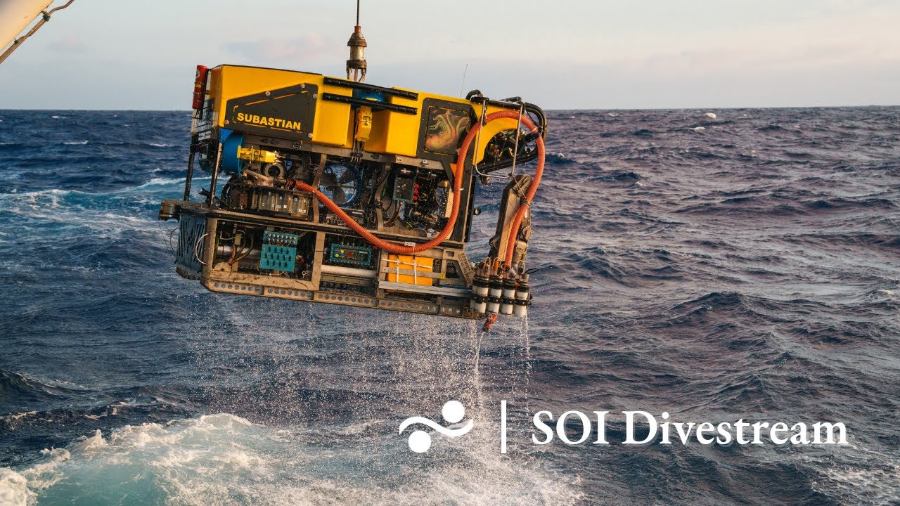
Situado en el sector central del área de estudio, el punto de descenso
se encuentra a una distancia lineal de 330 km (178 millas náuticas) de la localidad de Placido Rosas
(Treinta y Tres), en dirección sureste. Además, está a 188 km (101 millas náuticas) de Castillos
(Rocha) y a 310 km (167 millas náuticas) de San Jacinto (Canelones). Es una estación somera ubicada
en el borde externo de la Plataforma Continental, a una profundidad entre 160 y 200 metros, cerca
de la cabecera del cañón submarino La Paloma. Se caracteriza por la presencia de agregaciones de
montículos carbonáticos asociados con corales duros (Desmophyllum pertusum), y resulta de interés
verificar la presencia de corales vivos. Este es uno de los numerosos sitios similares mapeados en
2010. Este monte identificado como “N” presenta una longitud y ancho máximo de 304 y 175
metros respectivamente; y una altura máxima de 6 metros. El sitio se encuentra bajo la influencia de
la corriente de Brasil, que transporta Aguas Tropicales y Aguas Centrales del Atlántico Sur. Es
posible que se presenten corrientes fuertes, aunque se desconoce el estado de la visibilidad.
Dive Description (English):
Located in the central sector of the study area, the landing point is located at a linear distance of
330 km (178 nautical miles) from the town of Placido Rosas (Treinta yTres), in a southeasterly
direction. It is also 188 km (101 nautical miles) from Castillos (Rocha) and310 km (167 nautical
miles) from San Jacinto (Canelones). It is a shallow station located on the outer
edge of the Continental Shelf, at a depth between 160 and 200 meters, near the head of the La
Paloma submarine canyon. It is characterized by the presence of aggregations of carbonate mounds
associated with hard corals (Desmophyllum pertusum), and it is of interest to verify the presence of
live corals. This is one of numerous similar sites mapped in 2010. This mound, identified as "N," has
a maximum length and width of 304 and 175 meters, respectively. and a maximum height of 6
meters. The site is under the influence of the Brazil Current, which carries Tropical and Central
Waters of the South Atlantic. Strong currents are possible, although visibility is unknown.
FKt250812 - Visualizing the Deep Off Uruguay #UruguaySUB200 #DeepWaterUruguay
More expedition information: https://schmidtocean.org/cruise/visua...
More ROV SuBastian information: https://schmidtocean.org/technology/r...
_________
We livestream our ROV dives on YouTube, Facebook, and Twitch!
Join us on our oceanographic missions on our other social media platforms:
YouTube: / schmidtocean
Twitch: / schmidtocean
Twitter: / schmidtocean
Instagram: / schmidtocean
Live data feeds from R/V Falkor (too):
🚢 Where's Falkor (too)? https://soi-vessel-tracker.web.app/
🌦️ How's the weather? https://www.windy.com/station/ship-zgoj7
Sign up for our newsletter here:
Newsletter link: https://mailchi.mp/schmidtocean.org/s...
_________
Schmidt Ocean Institute is a 501(c)(3) private non-profit operating foundation established to advance oceanographic research, discovery, and knowledge, and catalyze sharing of information about the oceans.
Повторяем попытку...

Доступные форматы для скачивания:
Скачать видео
-
Информация по загрузке: