Intergrating landscape visualisations and archaeology
Автор: TALE: The Archaeology Lecture E-library
Загружено: 2026-02-27
Просмотров: 61
Описание:
Kristina Kraweic (York Archaeology)
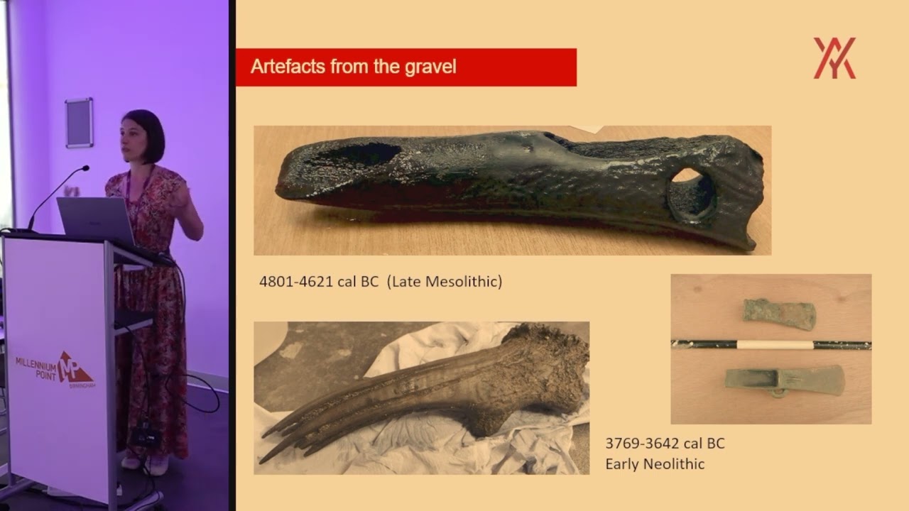
During aggregate extraction archaeological monitoring is routinely carried out, often over long periods of time. Alongside set piece excavations that are undertaken periodically, survey data is captured on a bi-weekly basis over the life of the extraction. Often this data is overlooked as an important way to visualise deposits and landscapes that are completely removed during the extraction process. By combining this more mundane data capture with lidar and photogrammetry, these sites, which are often inaccessible to the wider public, can be reconstructed and disseminated in a more engaging way.
Повторяем попытку...
Доступные форматы для скачивания:
Скачать видео
-
Информация по загрузке: