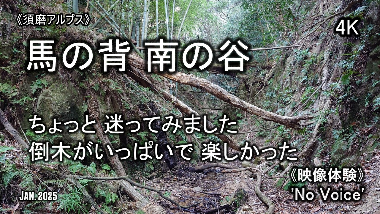
《馬の背 南の谷》ちょっと迷いましたが それも楽しかったです😅⛰️🌳 (No Voice / Nature Sounds / POV) 須磨アルプス 天井川右俣 谷 登山 平尾山 妙法寺
Автор: 【やま散歩】since 2019
Загружено: 2026-02-10
Просмотров: 207
Описание:
今回も須磨アルプスです。馬の背の下に出る谷を探検してきました🙋 吉備出版の六甲山系登山詳細図によると「天井川右俣ルート」みたいです。「須磨の名水」、「天皇の池」の谷は左俣ルートとありました⛰️ 最寄りは「月見山駅」ですが、そこからは歩いたことがあるので「須磨寺駅」からスタート🏃♂️➡️ 「須磨離宮公園」の正門前を通って、第二神明道路の手前でショートカットして、いつもの?取付きから入りました。取付きにはボーイスカウトが集合中👨👩👧👦 今日は何をするのかな? 天井川左俣との分岐でチェーンスパイクを履いて、二股を右へ(天井川右俣へ)。入口に「立入禁止」とありましたが、私設のようなので自己責任で進ませてもらうことにしました😋😅 わりと最初から荒れている感じなのと、入口の「立入禁止」が気になって最初はドキドキしながら進みました。左俣もそうでしたが、こちらも倒木が多かったですし、また足元も滑りやすいところもあり、道幅もほんとに狭いところもあり、ちょっと危ないですが楽しく進めました😉 途中で道迷いもしましたが… 途中、馬の背の手前で西に上がる分岐が二つある感じだったので、機会があったらそちらも上がってみたいです。馬の背に上がって今日の景色を見た後、横尾山までの北側に下りるルート(妙法寺駅方面)があるようなので探しながら進みましたが見つけられず😉 結局、横尾山頂から北に進む道で下りました。このルートも結構激しい斜面でしたが楽しかったです🕺 妙法寺駅から帰途に着きました🚃🏃♂️➡️
YAMAP👉 https://yamap.com/activities/45631757
ヤマレコ👉 https://www.yamareco.com/modules/yama...
撮影機材(DJI Osmo Pocket 3)👉 https://amzn.to/404JMJX
Translation by Microsoft Copilot:
This time I went to the Suma Alps again. I explored the valley that comes out below Uma-no-se (the “Horse’s Back”). According to the detailed Rokko Mountain Range map published by Kibi Publishing, this seems to be the Tenjogawa Right Fork Route. The valleys with “Suma’s Famous Spring” and “Emperor’s Pond” are listed as the Left Fork Route. The closest station is Tsukimiyama, but since I’ve walked from there before, I started from Sumadera Station instead. I passed in front of the main gate of Suma Rikyu Park, took a shortcut just before the Daini Shinmei Road, and entered from the usual trailhead. A group of Boy Scouts was gathering there—wonder what they were up to today. At the junction with the Tenjogawa Left Fork, I put on my chain spikes and headed right toward the Tenjogawa Right Fork. There was a “No Entry” sign at the entrance, but it looked privately posted, so I proceeded at my own risk. From the beginning, the route felt rough, and the “No Entry” sign stayed in the back of my mind, so I was a bit nervous at first. Like the left fork, this side also had many fallen trees, slippery spots, and some very narrow sections. A bit dangerous, but still fun to walk through. I even got lost along the way. Near Uma-no-se, it looked like there were two branches that climb westward, so I’d like to try going up those next time. After climbing up to Uma-no-se and enjoying the view, I continued on while looking for the route that supposedly descends north toward Myōhōji Station, but I couldn’t find it. In the end, I descended via the trail that goes north from the summit of Yokoo Mountain. That route also had some steep slopes, but it was enjoyable. From Myōhōji Station, I headed home.
#須磨の名水 #天皇の池 #須磨アルプス #馬の背 #六甲山 #novoice #hikinginjapan #バリ山行
00:00 タイトル
05:56 二俣へ(天井川右股へ)
16:11 この後 迷走します
26:52 まもなく脱出
34:30 横尾山から北側へ
45:06 マイナールートの取り付きを確認
Повторяем попытку...
Доступные форматы для скачивания:
Скачать видео
-
Информация по загрузке: