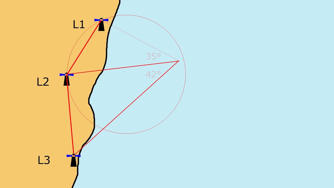
Using horizontal sextant angles to plot the ship's position at sea
Автор: Steering Mariners
Загружено: 2019-04-07
Просмотров: 9158
Описание:
This video focuses on explaining the procedure for obtaining and measuring the horizontal sextant angle between three structures located widely apart.
The horizontal sextant angles, thus obtained, are then used to plot the vessel's (ship's) position at sea.
The three structures (island, lighthouse, etc.) should be separated as widely as possible (recommended minimum angle is 45 degrees or more). However, if it is not possible to find three such structures, mariners may use the best three structures available to them at sea.
Previous videos have explained the method for obtaining the vertical sextant angle and the celestial body altitude using the sextant.
• Measuring vertical sextant angles
• How do you use a sextant to measure celest...
Повторяем попытку...

Доступные форматы для скачивания:
Скачать видео
-
Информация по загрузке: