Civil 3D Slope Analysis of Surface Overview
Автор: Seiler Geospatial
Загружено: 2022-09-07
Просмотров: 9170
Описание:
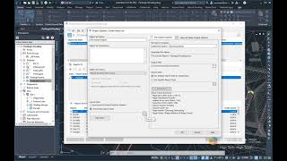
As a civil designer or engineer, there are a lot of useful tools within Civil 3D to help get a quick look at the surface using different parameters and showing different information including elevations, slope, slope directions, and more. The analysis tab within the surface properties dialogue box has several different ways to display this and show the desired information on both the surface and a data table called a legend.
In this video, you'll get an overview of the Slope Analysis tool, Watershed analysis, a glimpse into a few other analysis tools, how to create legends of your surface analysis results, why you may want to use specific tools, and how to display and modify the display for those surfaces analysis within Civil 3d 2023.
As always, reach out ( [email protected] ) if you have any questions regarding this video, other Autodesk products, or would like more information on how we can help you with your workflow.
Повторяем попытку...

Доступные форматы для скачивания:
Скачать видео
-
Информация по загрузке: