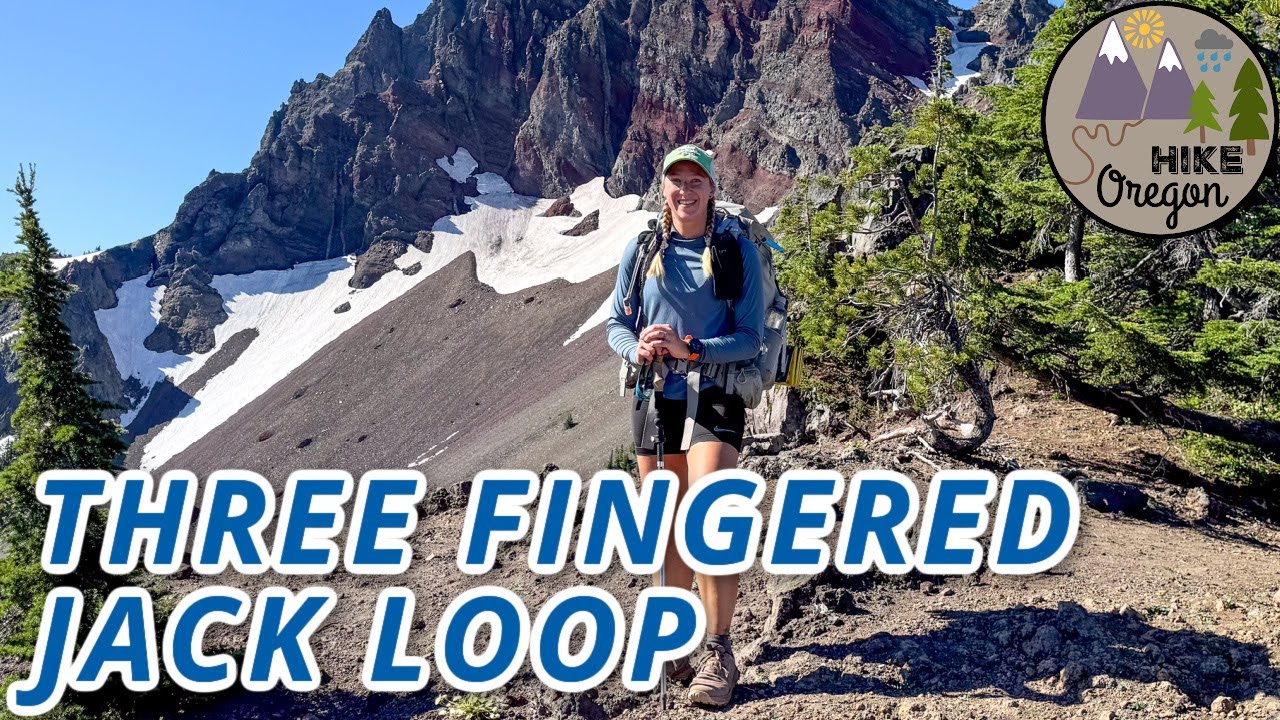
Full Climb [CC]: Three Fingered Jack 'South Ridge' (Central Oregon)
Автор: The Outbound Mind
Загружено: 2025-04-05
Просмотров: 655
Описание:
In central Oregon is a series of isolated, breathtaking volcanos. They belong to the Cascade Range, spanning Northern California, Oregon, Washington, and British Columbia in Canada. Summiting is attainable for all skill levels—from new hiker to seasoned mountaineer.
Three Fingered Jack (TFJ) is an excellent introduction to mountaineering on the Cascades. At height 7,844 feet, it is second lowest of that central Oregon group, but a gnarly-looking monster fully displaying its sharpened teeth. So eroded, a strong enough gust could potentially collapse the whole damn mess.
The south ridge appears to be the only viable and safest option. Beginning from a trailhead adjacent to United States Highway 20 at Santiam Pass, the approach heads north via approximately five miles of the Pacific Crest Trail (PCT; which runs through the region), while gaining 1,500 feet. Then, an exit from the PCT to a climber's trail—or snow hiking in the early-season—to reach the climbing route.
From their starting point near a saddle on the south ridge, climbers must scramble over half a mile and gain 1,000 feet. Of horrendous volcanic choss that clearly detests their presence. And near the top is where TFJ saves its three brief technical pitches, with a nearly-90° chimney serving as crux. But combining non-bomber holds of typical igneous rock origin and them being hidden (during the downclimb) by two projecting bands on the main chimney wall, it may be among the spiciest/craziest Yosemite Decimal System 5.2-rated climbs anywhere. To return, obviously revert the same 6-something miles and lose 3,000 feet back to Santiam Pass Trailhead.
Scenery from TFJ summit is what dreams are made of. Mount Jefferson commands the northern perspective. In opposite, southern view presents Mount Washington, the Three Sisters, Broken Top, and Mount Bachelor. Black Butte, to the east, is much smaller in stature but eye-catching nonetheless. And to the west are the PCT, lakes, and countless lesser mountains/hills extending to the Pacific Ocean.
Photos: https://photos.app.goo.gl/Q662P2yKAEE...
Route: Pacific Crest Trail-'south ridge'
Type: Out-And-Back
Distance: 12.5 miles
Total Elevation Gain: 3,001 feet
Total Technical Climbing: ~35 feet
Structure: Ledge; high step; chimney
Material: Basalt; andesite
Rating: 5.2
Pitch: 3
Location: Mount Jefferson Wilderness, Willamette National Forest, Oregon, USA
Date/Time: 2024-06-20 0651
00:00:00 Title; Important; Itinerary
02:28:21 Exiting Pacific Crest Trail to 'south ridge'
02:51:22 Scrambling up 'south ridge'
03:32:55 Technical rock climbing pitches
03:47:09 Summit
03:52:38 Downclimbing technical pitches
04:14:10 Scrambling down 'south ridge'
04:51:15 Leaving 'south ridge' for Pacific Crest Trail
05:09:22 Returning to Pacific Crest Trail
07:22:06 Trailhead
#hiking #climbing #mountaineering #rockclimbing #LeaveNoTrace
Повторяем попытку...
![Full Climb [CC]: Three Fingered Jack 'South Ridge' (Central Oregon)](https://imager.clipsaver.ru/W7dkZvETeWs/max.jpg)
Доступные форматы для скачивания:
Скачать видео
-
Информация по загрузке:
![Full Hike [CC]: Better Together at Shepherd Pass in the Sierra Nevada Range of California, Part 2b](https://imager.clipsaver.ru/FTxoEHYH7Zk/max.jpg)


![Full Hike [CC]: Most Difficult, Least Common Grand Canyon South Rim-South Rim Hike (Arizona)](https://imager.clipsaver.ru/VpQJnO3dHcM/max.jpg)


![Full Hike [CC]: Better Together at Shepherd Pass in the Sierra Nevada Range of California, Part 2a](https://imager.clipsaver.ru/wjREUi9ybRM/max.jpg)

![Full Climb [CC]: 'Little Bear Peak to Blanca Peak Traverse' in Colorado, Part 1](https://imager.clipsaver.ru/wkeFrg6sjBs/max.jpg)


![Full Hike [CC]: Barrierless in Far-Flung Horseshoe Canyon (Canyonlands National Park, Utah)](https://imager.clipsaver.ru/L9wcHXqH8Bw/max.jpg)