Kedarnath Trek | June 2013 | Before 10 hours of flash flood | Uttarakhand | HD
Автор: TraverseXP
Загружено: 2017-09-13
Просмотров: 10001
Описание:
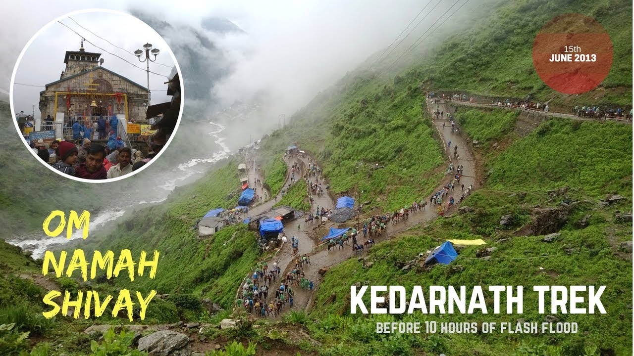
Kedarnath is situated at an altitude of 3586 m (11,755 ft) in the lap of the majestic mountain peaks and near the head of river Mandakini. A 17 km trek from Gaurikund will lead to Kedarnath. Do not believe in milestones as the distances are wrongly mentioned.You need to have a bamboo stick, woolen clothes, raincoats and lots of water. Tough yet beautiful trek.... Spiritual journey with a majestical view of the Himalayas ...Om namah shivay! 🙏
Camera Used: Nokia Lumia 620
#Music Credits
Laid Back Guitars by Kevin MacLeod is licensed under a Creative Commons Attribution licence (https://creativecommons.org/licenses/...)
Source: http://incompetech.com/music/royalty-...
Artist: http://incompetech.com/
-------TraverseXp India--------
Share, Support, Subscribe!!!
Subscribe: https://goo.gl/tD9YhN
Twitter: / traversexpindia
Instagram: / traversexpindia
Facebook: / traversexpindia
Facebook Myself: https://goo.gl/NeCb5c
Google Plus: https://goo.gl/2seYk6
About : TraverseXp India is a YouTube Channel, where you will find incredible travel and outdoor videos :)
#kedarnath, #Uttarakhand, #trekking,
Повторяем попытку...
Доступные форматы для скачивания:
Скачать видео
-
Информация по загрузке:


