Visualization of Bihar 2024 Flood-Affected Areas Using Google Earth Engine (GEE)
Автор: Geospatial Tv
Загружено: 2024-09-27
Просмотров: 205
Описание:
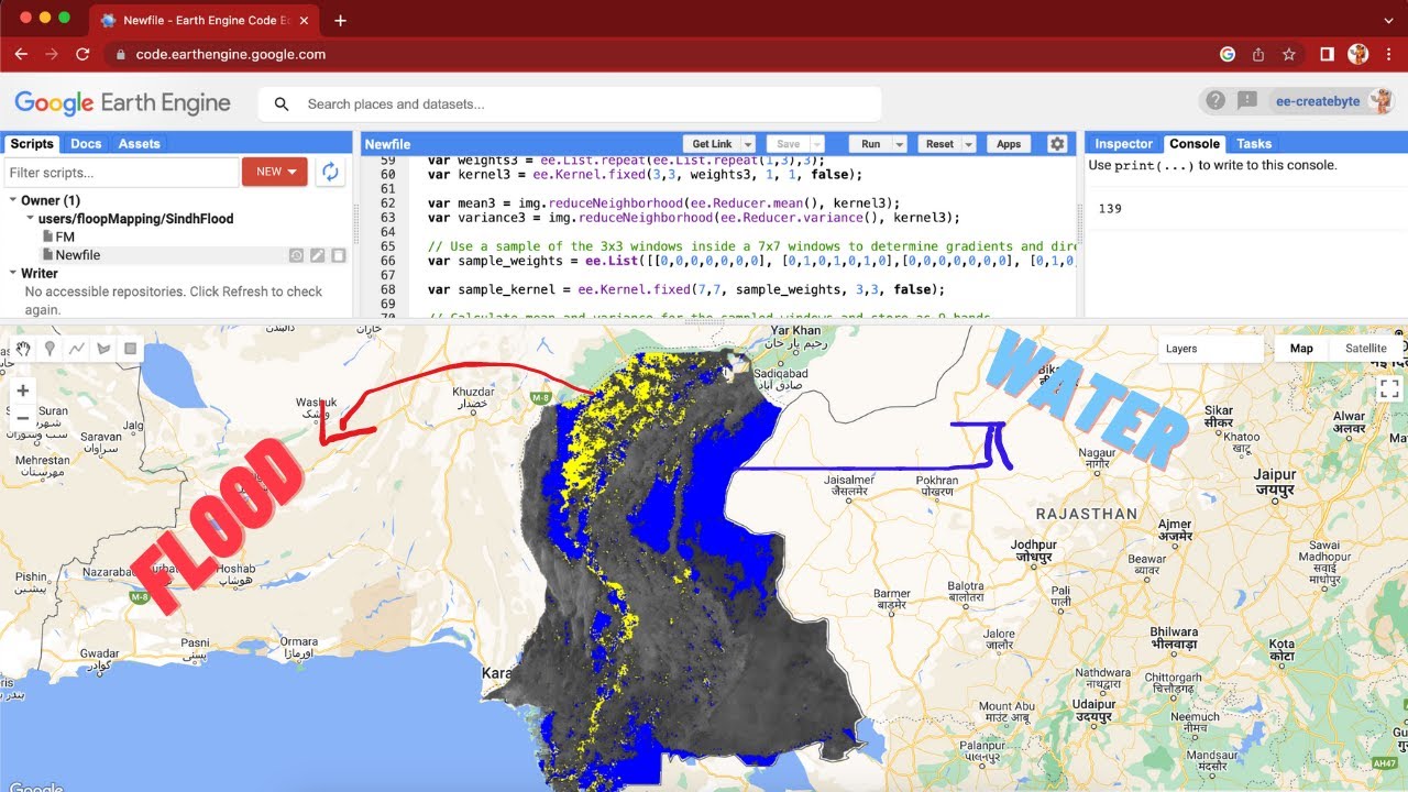
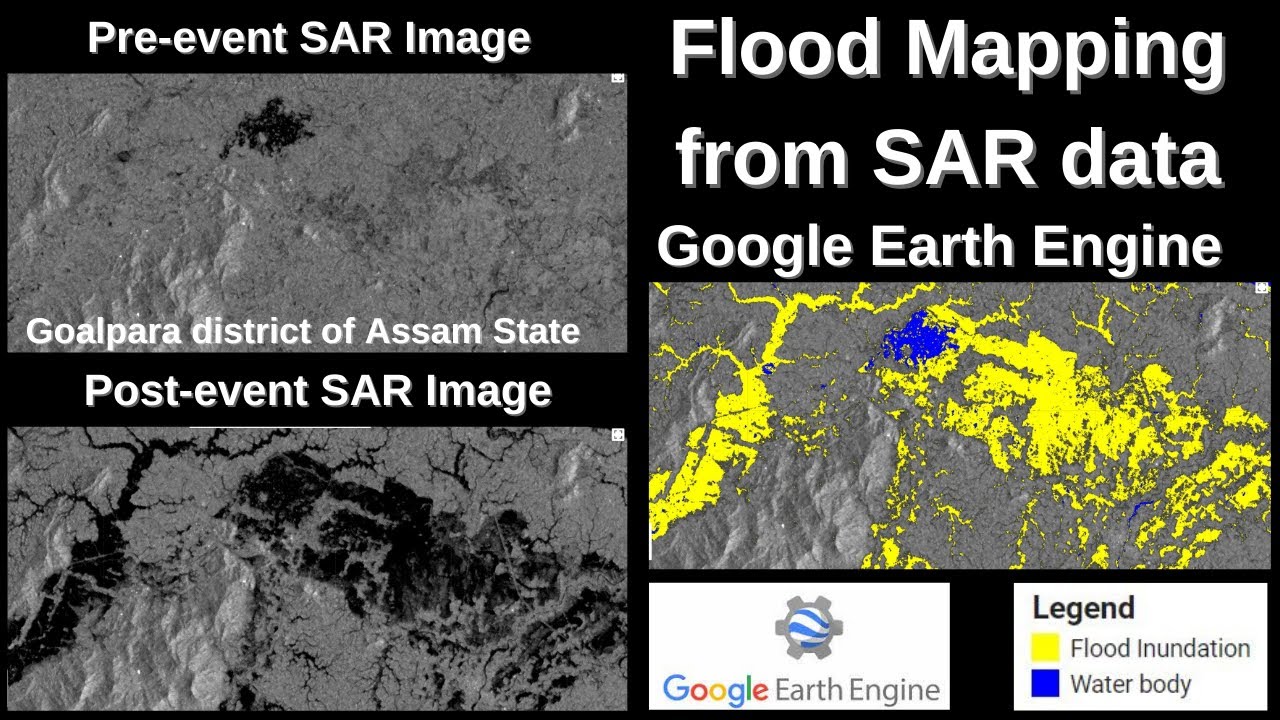
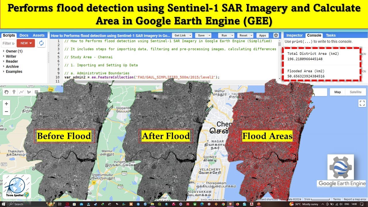
In this video, we explore the devastating 2024 floods in Bihar through powerful geospatial data analysis using Google Earth Engine (GEE). Watch as we visualize the flood-affected regions and the extent of damage using satellite imagery and advanced mapping techniques.
Key highlights of the video include:
Accessing real-time satellite data with GEE
Identifying flood-affected areas in Bihar
Analyzing flood extent and impact using remote sensing techniques
Visualizing the data on an interactive map
This tutorial offers an in-depth understanding of how remote sensing and geospatial tools can be used to monitor natural disasters and provide actionable insights. Whether you're a geospatial analyst, disaster management professional, or curious learner, this video will help you grasp the potential of GEE in flood monitoring and visualization.
Don't forget to like, share, and subscribe for more GIS and remote sensing content!
Follow us on LinkedIn & Instagram @geospatialtv
Повторяем попытку...

Доступные форматы для скачивания:
Скачать видео
-
Информация по загрузке: