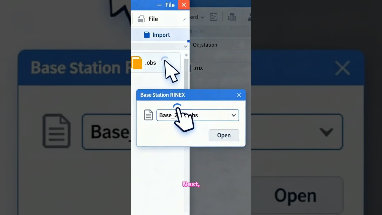
GPS Data processing in Survey Master
Автор: The Geo Mapping
Загружено: 2026-01-08
Просмотров: 41
Описание:
🌍 Welcome to The Geo Mapping – Learn GIS, Remote Sensing & Mapping Made Easy!
This channel is your complete guide to mastering GIS (Geographic Information Systems) and Remote Sensing tools. Learn how to use top software like ArcGIS, QGIS, ERDAS Imagine, ENVI, and Google Earth Engine with simple, step-by-step tutorials.
🛰️ What You’ll Learn:
GIS basics to advanced spatial analysis
Remote sensing image processing & classification
Digital mapping, geospatial data visualization & analysis
Real-world GIS projects & tips for professionals and students
Whether you’re new to GIS or want to level up your geospatial career, you’ll find practical lessons, project-based learning, and easy explanations here.
📍 Subscribe now and start your journey in GIS, Remote Sensing, and Geospatial Technology today!
#GIS #RemoteSensing #Mapping #Geospatial #ArcGIS #QGIS #SatelliteData #GISProjects #LearnGIS
Повторяем попытку...
Доступные форматы для скачивания:
Скачать видео
-
Информация по загрузке:


