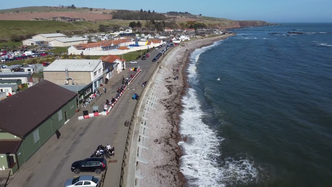
Stonehaven Beach Front Aberdeenshire March 2022
Автор: Scottishscruffybiker
Загружено: 2022-03-19
Просмотров: 309
Описание:
Stonehaven Beach Front Aberdeenshire March 2022
Stonehaven (/stoʊnˈheɪvən/ (audio speaker iconlisten); [stinˈhaiv] (audio speaker iconlisten)) is a town in Scotland. It lies on Scotland's northeast coast and had a population of 11,602 at the 2011 Census.
Stonehaven is a popular coastal resort, which is well used by watersports enthusiasts.
Stonehaven Beach is approximately 1.1 km in length, bound by the outflow of the River Carron and the harbour jetty to the south, and rocky outcrops at the northern end.
The southern end of the bay is sandier and therefore gets greater usage by bathers. An electric sign displaying real-time bathing water quality predictions is available at this beach in summer months, and you can find out the daily prediction by visiting the SEPA website.
Stonehaven is 15 miles (24 km) south of Aberdeen sheltered in Stonehaven Bay.
The Carron Water and Cowie Water run through the town. Stonehaven lies adjacent to a deeply indented bay surrounded on three sides by higher land between Downie Point and Garron Point. The harbour, consisting of two basins, was improved in the 1820s by the engineer Robert Stevenson (grandfather of the author Robert Louis Stevenson), and became an important centre of the 19th century herring trade; the harbour is bordered on the north by Bellman's Head and the south by Downie Point.
At the western edge of Stonehaven west of the A90 road lies the village of Kirkton of Fetteresso. Nearby to the south, Fowlsheugh is a coastal nature reserve, known for its 230-foot-high cliff formations and habitat supporting prolific seabird nesting colonies.
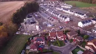
Stonehaven has grown rapidly since the oil boom in Aberdeen. The increasing demand for new, middle class housing has seen four new estates being appended to the town, creating an expanse of suburbs and Stonehaven has been bypassed since 1984.
Because of its location at the confluence between two rivers, Stonehaven is prone to flooding following heavy rain. Aberdeenshire Council has held meetings about the possible construction of flood defences. These are currently under construction.
The Highland Boundary Fault traverses Scotland from the Isle of Arran and Helensburgh on the west coast to immediately north of Stonehaven on the east coast.
Stonehaven is the site of prehistoric events evidenced by finds at Fetteresso Castle and Neolithic pottery excavations from the Spurryhillock area.
In 2004, archaeological work by CFA Archaeology, in advance of the building of the Aberdeen to Lochside Natural Gas Pipeline, found two short cists burials containing cremated remains to the southwest of Stonehaven.
Radiocarbon dating put the burials at the first half of the 2nd millennium BC, which was the Early Bronze Age in Scotland. The burials contained stone tool artefacts and shale/cannel coal beads.
The town lies at the southern origin of the ancient Causey Mounth trackway, which was built on high ground to make passable this only available medieval route from coastal points south to Aberdeen.
This ancient passage specifically connected the Bridge of Dee to Cowie Castle via the Portlethen Moss and the Stonehaven central plaza.
The route was that taken by the Earl Marischal and Marquess of Montrose when they led a Covenanter army of over 9,000 men in the first battle of the English Civil War in 1639.
Originally the settlement of Stonehaven grew and prospered and was known as Kilwhang.
The Covenanters were imprisoned in Dunnottar Castle, where many died. A memorial to them can be found in Dunnottar Church. Other castles in the vicinity are Fetteresso Castle and Muchalls Castle, both of which are in private ownership and not open to the public. The oldest surviving structure in Stonehaven is the Stonehaven Tolbooth at the harbour, used as an early prison and now a museum.
Dunnottar Castle, perched atop a rocky outcrop, was home to the Keith family, and during the Scottish Wars of Independence, the Scottish Crown Jewels were hidden there. In 1296, King Edward I of England took the castle only for William Wallace to reclaim it in 1297, burning down the church in the process with the entire English garrison still in it. In 1650, Oliver Cromwell sacked the castle to find the Crown Jewels following an eight-month siege (having previously destroyed the English Crown Jewels).
However, just before the castle fell, the Crown Jewels were smuggled out by some ladies who took them by boat to a small church just down the coast in the village of Kinneff, where they remained undetected for eleven years.
Near the Cowie Bridge, at the north of Stonehaven, was a fishing village known as Cowie, which has now been subsumed into Stonehaven. Somewhat further north are the ruins of Cowie Castle. Slightly to the west of Stonehaven is the ruined Ury House, originally a property of the Frasers.
A fossil of the oldest known land animal, Pneumodesmus newmani, a species of millipede, was found at Stonehaven's Cowie Beach in 2004.
Повторяем попытку...
Доступные форматы для скачивания:
Скачать видео
-
Информация по загрузке: