Breathtaking Drone Footage of a Hidden Welsh Reservoir
Автор: AerialPerspectives24
Загружено: 2025-06-15
Просмотров: 85
Описание:
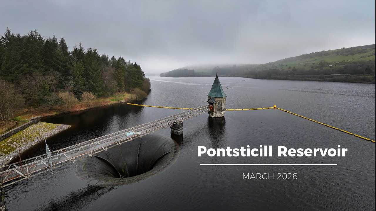
Pontsticill Reservoir (Welsh: Cronfa Pontsticill) or Taf Fechan Reservoir is a large reservoir on the Taf Fechan lying partly in the county of Powys and partly within the county borough of Merthyr Tydfil in south Wales. It lies within the Brecon Beacons National Park and Fforest Fawr Geopark.
Pontsticill Reservoir
Pontsticill Reservoir
Location
Taf Fechan
Coordinates
51°48′56″N 3°22′17″W
Lake type
reservoir
Basin countries
United Kingdom
Surface area
102 ha (250 acres)
Max. depth
30 m (98 ft)
Surface elevation
330 m (1,080 ft)
Bell-mouth spillway and valve tower
The 110 ft high embankment has, since its completion in 1927, been holding back 15,400 megalitres of water for supply to industry and population to the south. At maximum fill level, the modern reservoir is continuous with Pentwyn Reservoir (sometimes referred to as Dol-y-gaer Reservoir or Lake) which suffered major water losses after completion due to the presence of major fractures in the bedrock beneath its dam relating to the Neath Disturbance, a major geological fault which runs northeast to southwest through the area.
The Brecon Mountain Railway (Welsh: Rheilffordd Fynydd y Bannau) is a 1 ft 11+3⁄4 in (603 mm) narrow gauge tourist railway on the south side of the Brecon Beacons in Wales. It climbs northwards from Pant along the full length of the Pontsticill Reservoir (also called 'Taf Fechan' reservoir by Welsh Water) and continues past the adjoining Pentwyn Reservoir to Torpantau railway station. The railway's starting point at Pant is located two miles (3 km) north of the town centre of Merthyr Tydfil, Merthyr Tydfil County Borough, South-East Wales.
Повторяем попытку...

Доступные форматы для скачивания:
Скачать видео
-
Информация по загрузке: