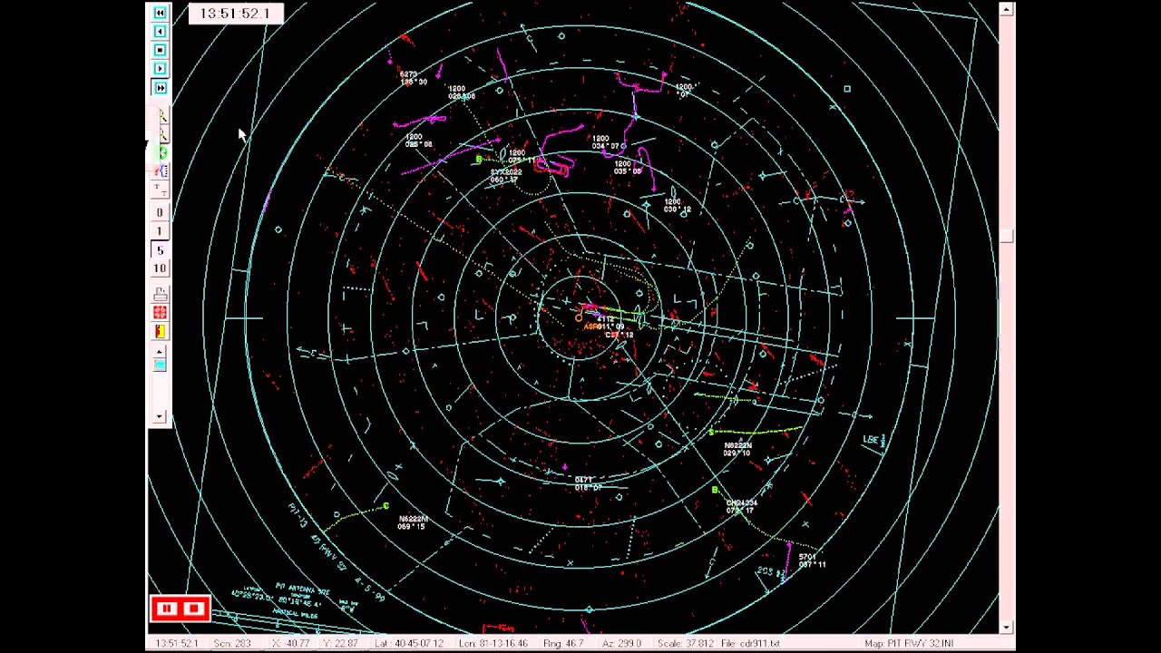
Albuquerque ARTCC, Sector 50, October 2007
Автор: Bill-NM
Загружено: 2012-04-23
Просмотров: 5572
Описание:
Air traffic controller working a high altitude sector, located in north-central Arizona, This sector works mostly east/west traffic to and from southern California, but also includes a large amount of traffic departing Phoenix, AZ (lower left area of screen), climbing up into, and joining, the existing enroute/overflight traffic. What is not depicted in this view (the device that records this video has limited capabilities), is a bit of weather/rain/clouds in the east-central portion of the sector.
The clouds, in this case, TALL thunderstorm-type clouds, could contain moderate to severe turbulence, and therefor must be avoided. You will hear several aircraft asking to "deviate"...this means they need to deviate off their assigned course, so as to maneuver around this bad weather. An aircraft must ask and get approval from the controller before deviating, as the change in course could, and often does, lead to a conflict with another aircraft.
The block of information near each aircraft's actual radar target, is the "data block". They have 4 lines of information and are connected to the target via a "leader line"...1st line of information - callsign, 2nd line - altitude...if it is 3 digits, the aircraft is level at their assigned altitude, if it's six digits, it shows the assigned altitude (the altitude the aircraft is climbing or descending to), followed by its current altitude, 3rd line - first three digits are a computer identification number used by the controller to make changes to the datablock via his computer keyboard, second three digits are the ground speed. Fourth line - the destination airport's three-letter identifier.
Повторяем попытку...

Доступные форматы для скачивания:
Скачать видео
-
Информация по загрузке:


![ATC RADAR | [ ZLA ] | Los Angeles Center (ZLA30 SECTOR)](https://imager.clipsaver.ru/M6Exb4gwvB4/max.jpg)