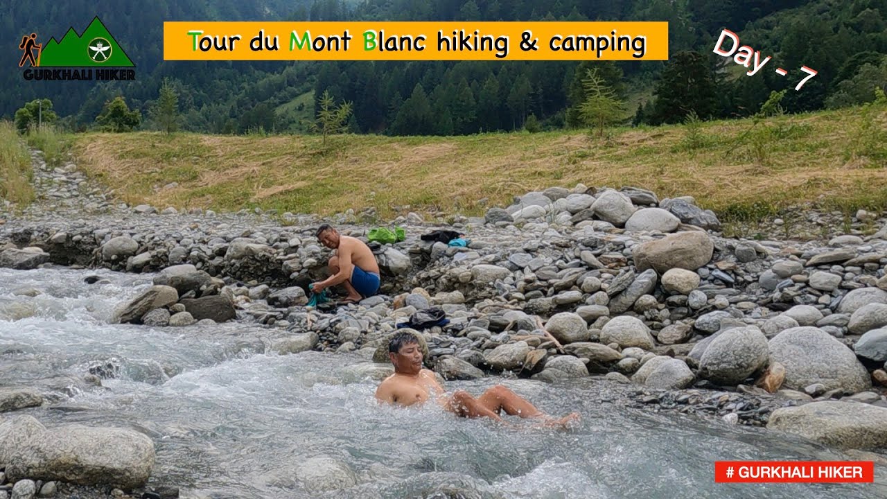
ENG SUB) Tour du Mont Blanc DAY 7: Epic Views and Challenging Trails! (Champex-Lac to Le Peuty)
Автор: GURKHALI HIKER
Загружено: 2024-09-03
Просмотров: 199
Описание:
The section of the Tour du Mont Blanc (TMB) from Champex-Lac to Le Peuty is one of the most scenic and varied segments of this iconic trail. Here's a detailed guide to hiking and camping along this stretch:
Overview
Distance: Approximately 15 km (9.3 miles)
Duration: 5-7 hours, depending on your pace and stops
Elevation Gain: Around 800 meters (2,625 feet)
Elevation Loss: Around 950 meters (3,117 feet)
Difficulty: Moderate, with some steep ascents and descents
Route Description
1. Champex-Lac
Starting Point: Champex-Lac, a picturesque village by a lake at 1,470 meters (4,823 feet).
Facilities: Shops, restaurants, and accommodations are available here. It’s a good place to stock up on supplies.
2. Champex-Lac to Plan de l’Au
Distance: About 4 km (2.5 miles)
Description: The trail starts with a gentle ascent through forests and meadows. The path is well-marked, and you’ll enjoy lovely views of the surrounding mountains.
Camping: Wild camping is not permitted in this section, but you may find some spots slightly off the trail if necessary. Check local regulations.
3. Plan de l’Au to Bovine
Distance: About 3 km (1.9 miles)
Elevation Gain: Steep ascent of about 500 meters (1,640 feet)
Description: This section is challenging, with a steep climb through forests and rocky paths. The trail can be muddy and slippery, especially after rain.
Bovine: A high alpine pasture offering stunning views of the Rhone Valley. This is a good spot to take a break and enjoy the panorama.
4. Bovine to Col de la Forclaz
Distance: About 4 km (2.5 miles)
Elevation Loss: Around 600 meters (1,969 feet)
Description: The trail descends steeply through forests and alpine meadows. The descent can be tough on the knees, so take your time. Col de la Forclaz (1,527 meters / 5,010 feet) is a popular stop with a mountain hotel and restaurant.
Camping: Wild camping is generally discouraged here, but you can inquire at the hotel for permission to pitch a tent nearby.
5. Col de la Forclaz to Le Peuty
Distance: About 4 km (2.5 miles)
Elevation Loss: About 300 meters (984 feet)
Description: This is a gentler descent through beautiful alpine scenery. You’ll pass through forested areas and open pastures, eventually reaching the small hamlet of Le Peuty.
Camping Options
Champex-Lac: There is a designated camping area in Champex-Lac.
Le Peuty: There’s a basic camping area at Le Peuty, near the hamlet. It’s a simple site with limited facilities, but it’s an official camping spot and a great place to end this section of the hike.
Tips
Water: Streams are available, but treat water before drinking. Carry enough water for the day, especially on the ascent to Bovine.
Weather: Be prepared for changing weather conditions. The weather can be unpredictable, especially at higher altitudes.
Gear: Good hiking boots, trekking poles, and rain gear are essential. The trail can be muddy, rocky, and slippery.
This section of the TMB offers a fantastic mix of forest trails, alpine meadows, and panoramic views, making it a memorable part of your Tour du Mont Blanc experience.
Повторяем попытку...
Доступные форматы для скачивания:
Скачать видео
-
Информация по загрузке: