164 countries backed a different map. America voted no.
Автор: Mind the World
Загружено: 2026-09-11
Просмотров: 294
Описание:
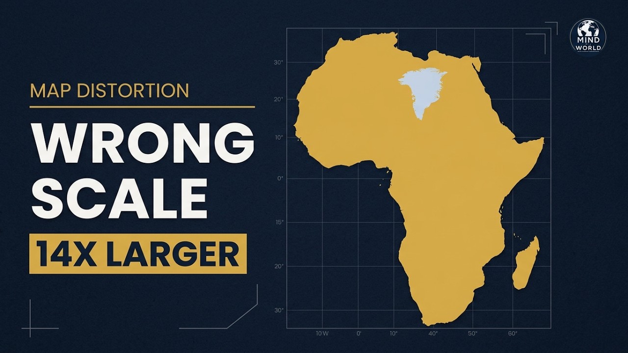
The world map most of us learned makes Africa look smaller than it is. On 4 September 2026, 164 United Nations members backed wider use of Equal Earth and other equal-area projections. The United States was the only country to vote no.
This episode explains why Mercator was invented, why it distorts land near the poles, what Equal Earth changes, why the United States objected, and how a non-binding vote could still change the map people carry in their heads.
No sides. No spin. No telling you what to think.
Chapters:
00:00 The map in your head
00:16 164 countries vote
00:30 Why Mercator was invented
00:59 The round Earth problem
01:13 Why Greenland looks enormous
01:31 Africa and Greenland
01:59 Why online maps kept Mercator
02:21 Correct the Map
02:39 Equal Earth
02:53 The UN vote
03:05 Robert Dussey's argument
03:18 What Equal Earth preserves
03:55 Why America voted no
04:31 The six abstentions
05:01 What the resolution changes
05:38 How maps actually change
06:00 The map and the planet
Primary sources and further reading:
UN meeting record: https://press.un.org/en/2026/ga12779....
UN resolution: https://documents.un.org/doc/undoc/lt...
UN Office of the Special Adviser on Africa: https://www.un.org/osaa/en/news/victo...
African Union statement: https://au.int/en/pressreleases/20260...
United States explanation of vote: https://usun.usmission.gov/explanatio...
Equal Earth projection: https://equal-earth.com/equal-earth-p...
Picture credits: NASA Apollo 8 and Apollo 17 crews; Rijksmuseum; Gerardus Mercator and Wilhelm Krucken; White House Photographic Office and the United States National Archives; AMISOM Public Information and Tobin Jones; United States Department of State; Dendodge. These photographs and historical images are public domain or released under CC0. Full source and rights details are recorded in the episode credits file.
Pictures: illustrated scenes are original editorial artwork made with AI tools. Photographs are licensed and real. United States government images are public domain. Maps and charts are drawn from published data. Nothing in this film is presented as documentary footage of an event.
#WorldMap #MercatorProjection #Africa #EqualEarth #Geography
Повторяем попытку...
Доступные форматы для скачивания:
Скачать видео
-
Информация по загрузке: