Urban Systems - Peachland Landslide - Drone footage
Автор: UrbanSystemsCanada
Загружено: 2017-03-10
Просмотров: 1071
Описание:
http://urbansystems.ca/urban-drone-ke...
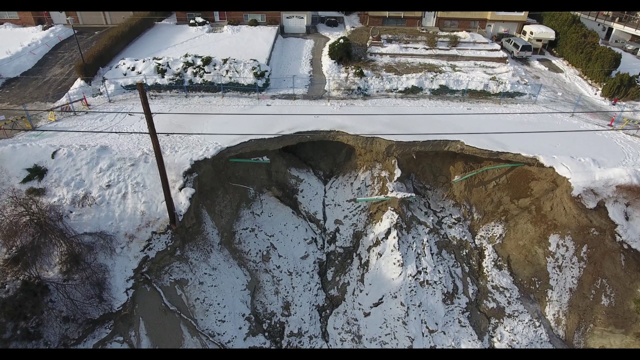
On January 6th, 2017 a landslide occurred three kilometres south of Peachland in British Columbia's Okanagan region. Nearly a full lane of Renfrew Road above the highway broke away. Due to the instability of the land near the edges, it was very dangerous to get close visuals or images to the site. A week after the landslide our Geomatics team worked closely with the District of Peachland and flew our drone overhead to obtain the visuals you see in this video. We helped provide incredibly valuable information including site video, still images, 3D models, topography, and slope cross-sections to aid in the assessment and plan for further remediation work.
For more information about the landslide visit, cbc.ca/news/canada/british-columbia/peachland-landslide-cause-unknown-1.3930700
Повторяем попытку...
Доступные форматы для скачивания:
Скачать видео
-
Информация по загрузке: