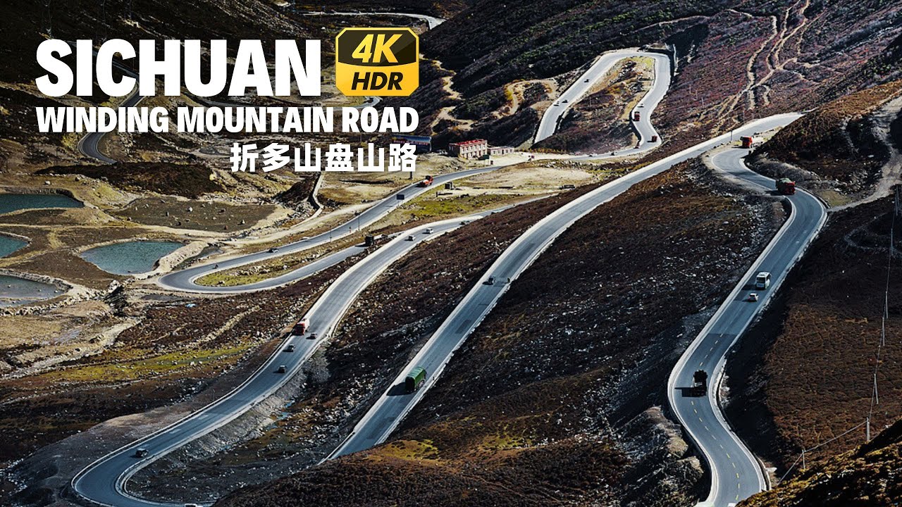
Sichuan Winding Mountain Road Driving - Zheduo Mountain Scenic Drive 4K HDR
Автор: Walk China - Канал автопутешествий
Загружено: 2024-10-02
Просмотров: 7498
Описание:
Zheduo Mountain is a mountain in Ganzi Tibetan Autonomous Prefecture, Sichuan Province. It belongs to the Hengduan Mountains and is a branch of the Daxue Mountains. It has an altitude of 4,962 meters.
In Tibetan, "Zheduo" means bend. The Sichuan-Tibet Highway 318 is extremely winding and the road conditions are dangerous here.
Zheduo Mountain is an important geographical dividing route. To its west is a plateau uplift zone, and to its east is a mountainous canyon zone. It is the watershed between the Yalong River and the Dadu River. The area to the east has a subtropical monsoon climate, and the area to the west is a mixture of subarctic monsoon climate and plateau continental climate. It is also the dividing line between Han and Tibetan cultures. After crossing Zheduo Mountain, you will officially enter the Khams Pa Tibetan area.
The Sichuan-Tibet Highway crosses the Zheduo Mountain Pass at an altitude of 4,297 meters. People are accustomed to using this mountain as the boundary, calling the eastern part "Guannei (inside the pass)" and the western part "Guanwai (outside the pass)".
From June 1935 to July 1936, the Fourth Front Army of the Red Army crossed the snow-capped mountains of Hongqiao Mountain, Zhueqiao Mountain, Mengbi Mountain, Jiajin Mountain, Dangling Mountain, and Zheduo Mountain. Many Red Army soldiers fell down from exhaustion and freezing, and fell asleep on the snow-capped mountains.
As of September 2024, the peak traffic volume on the Zheduo Mountain section of Highway G318 is 20,000 vehicles per day.
ROUTE OF THIS DRIVING: https://maps.app.goo.gl/6psSmiQavWWBv...
#chinatravel #drivingtour #sichuan #mountaindrive #highway
Повторяем попытку...
Доступные форматы для скачивания:
Скачать видео
-
Информация по загрузке:


![Поездка по красивым и захватывающим горам Тянь-Шань —[Кука-Байинбулуке]# Синьцзян, Китай🚗🚗🚗](https://image.4k-video.ru/id-video/yuVsgD2zlNc)