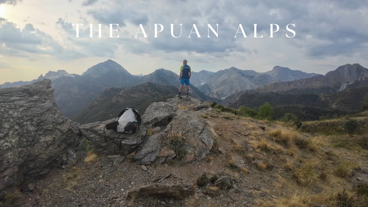
Silent hiking 55 Km in the Apuan Alps
Автор: SoloSilentHiker
Загружено: 2025-09-06
Просмотров: 192
Описание:
Le Alpi Apuane sono una catena montuosa situata nel nord-ovest della Toscana (Italia), incastonata tra le zone de la Lunigiana, la Garfagnana e la Versilia.
Questa traversata è stata compiuta in tre giorni e mezzo, percorrendo 55 Km da nord a sud, con un dislivello di +4.500 metri totali.
Giorno 1
Km: 7
Dislivello: +915 mt
Nell’ Agosto del 2025 io e il mio amico siamo partiti dal paese di Castelpoggio. Attraverso il sentiero Cai 185 siamo giunti al rifugio Carrara e i prati di Campocecina. Abbiamo trascorso la prima notte in tenda appena sotto la vetta del monte Borla, con vista mozzafiato sulla costa toscana dal golfo di La Spezia a Livorno.
Giorno 2
Km: 12
Dislivello: +957 -637 mt
Abbiamo percorso il sentiero Cai 173, oltrepassando la foce del Fanaletto e la foce di Vinca arrivando alla capanna Garnerone per la pausa pranzo. Siamo ripartiti percorrendo il sentiero Cai 137 arrivando al rifugio Orto di Donna per la cena. Abbiamo piazzato le tende all’esterno del bivacco K2, che era già stato occupato per la notte.
Giorno 3
Km: 20
Dislivello: + 1.253 – 1.759 mt
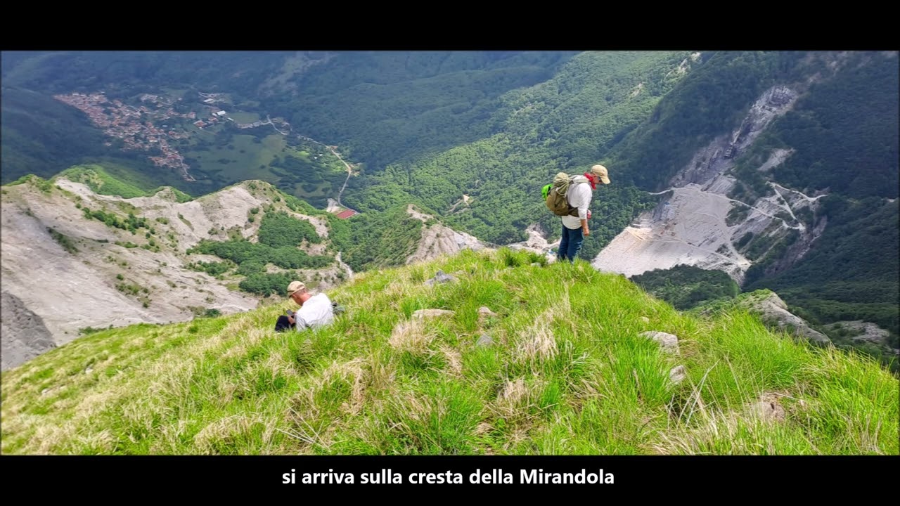
Salutato il mio amico, ho proseguito il cammino in solitaria. Ho percorso il sentiero Cai 179 passando per la foce di Cardeto e poi il sentiero Cai 148 attraverso la cava di marmo della Focolaccia. Dal passo della Focolaccia, ho iniziato la salita fino alla vetta del monte Tambura (1890 mt) per poi discendere sullo stesso sentiero fino al passo della Tambura. Ho percorso un tratto della Via Vandelli per 3 km fino ad incrociare il sentiero Cai 31 e da qui ho iniziato la salita giungendo al passo Sella. Ho intrapreso il sentiero Cai 150 per escursionisti esperti, attraversando la cresta dello Schienale dell’Asino con alcuni passaggi di primo grado ed esposizione su ambo i lati, per poi scendere fino al rifugio Puliti per la pausa pranzo. Sono ripartito percorrendo il sentiero Cai 141 arrivando al passo Croce dove ho trascorso la notte in tenda.
Giorno 4
Km: 16
Dislivello: + 1.030 - 1.380
Ho proseguito sul sentiero Cai 141 fino al rifugio Del Freo e poi il sentiero Cai 125 arrivando alla foce di Valli. Ho percorso la cresta del monte Forato attraverso il sentiero Cai 110 per poi discendere lungo il versate sud fino alla foce di Petrosciana. Percorrendo il sentiero Cai 121, sono giunto al rifugio Forte dei Marmi dove mi sono fermato per la pausa pranzo e da qui ho proseguito sullo stesso sentiero, fino all’Agriturismo “Il Paesaggio”, sopra il paese di Casoli dove ho trascorso l’ultima notte, terminando la mia traversata.
ABOUT THE HIKE
The Apuan Alps are a mountain range located in north-western of Tuscany (Italy), nestled between the areas of Lunigiana, Garfagnana and Versilia.
This crossing was completed in three and a half days, covering 55 km from north to south, with a total elevation gain of +4,500 metres.
Day 1
Km: 7
Elevation gain: +915 m
In August 2025, my friend and I set out from the village of Castelpoggio. We followed the CAI 185 trail to the Carrara refuge and the Campocecina meadows. We spent the first night in a tent just below the summit of Mount Borla, with a breathtaking view of the Tuscan coast from the Gulf of La Spezia to Livorno.
Day 2
Km: 12
Elevation gain: +957 -637 m
We followed CAI trail 173, passing the mouth of the Fanaletto and the mouth of the Vinca, reaching the Garnerone hut for lunch. We continued along CAI trail 137, reaching the Orto di Donna refuge for dinner. We pitched our tents outside the K2 bivouac, which had already been occupied for the night.
Day 3
Km: 20
Elevation gain: +1,253 – 1,759 m
After saying goodbye to my friend, I continued my hike alone. I followed CAI trail 179, passing the mouth of the Cardeto River, and then CAI trail 148 through the Focolaccia marble quarry. From the Focolaccia Pass, I began the climb to the summit of Mount Tambura (1,890 m), then descended on the same trail to the Tambura Pass. I followed a section of Via Vandelli for 3 km to the intersection with CAI trail 31, and from there I began the climb to the Sella Pass. I took the CAI trail 150 for experienced hikers, crossing the Schienale dell'Asino ridge with some first grade sections and exposure on both sides, then descended to the Puliti refuge for lunch. I returned to CAI trail 141, reaching the Passo della Croce, where I spent the night in a tent.
Day 4
Km: 16
Elevation gain: +1,030 - 1,380
I continued on CAI trail 141 to the Del Freo refuge and then on CAI trail 125, reaching the mouth of Valli. I followed the crest of Monte Forato via CAI trail 110 and then descended along the southern slope to the mouth of Petrosciana. Following CAI trail 121, I reached the Forte dei Marmi refuge, where I stopped for lunch. From there, I continued on the same trail to the "Il Paesaggio" farmhouse, above the village of Casoli, where I spent the last night, completing my crossing.
Повторяем попытку...
Доступные форматы для скачивания:
Скачать видео
-
Информация по загрузке: