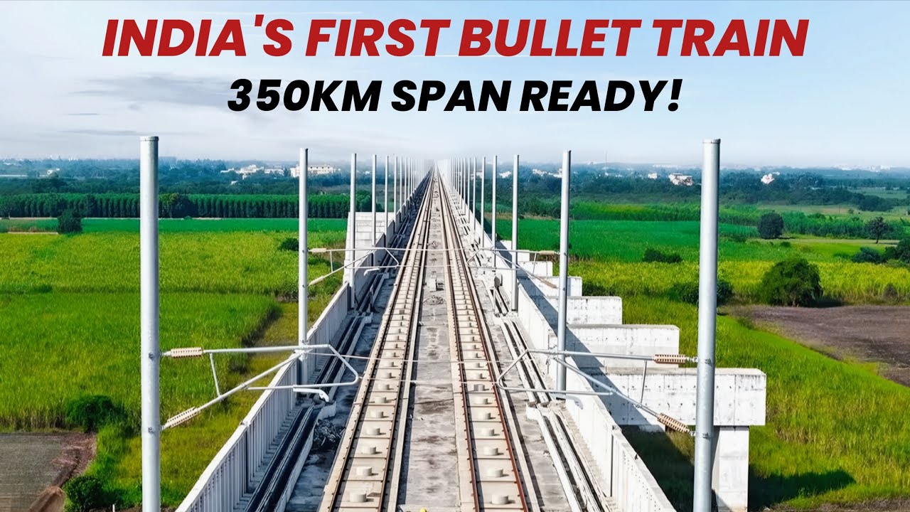
Is India's Bullet Train FINALLY Ready? 350 KM Span Completed | Full Route, Ground Reality and Update
Автор: Infra Insight
Загружено: 2025-12-28
Просмотров: 6251
Описание:
Traveling from Mumbai to Ahmedabad in just 2 hours? The reality is closer than you think! 🚅🇮🇳
In this video, we present a complete ground report and 3D route analysis of India's first High-Speed Rail (MAHSR) project. From the massive 21 KM underground tunnel at Thane Creek to the completed viaducts in Gujarat, witness the engineering marvel that is changing India forever.
Is the 2026 deadline for the Surat-Bilimora phase confirmed? What is happening 24 meters deep at BKC Station? We answer all your questions in this detailed breakdown.
📍 Key Highlights of this Video:
✅ The Speed: Understanding the 320 KMPH operational speed.
✅ The Route: Full map analysis of the 508 KM stretch (Maharashtra to Gujarat).
✅ The Tunnel: India's first 7 KM undersea rail tunnel explained.
✅ The Progress: Live ground status of pillars, bridges, and stations.
✅ The Train: Features of the Japanese Shinkansen E5 Series.
🔍 Topics Covered:
Mumbai Ahmedabad Bullet Train Project Status 2025
Thane Creek Undersea Tunnel Construction
National High-Speed Rail Corporation Limited (NHSRCL) Updates
Surat to Bilimora First Phase Trial Run
E5 Series Shinkansen Bullet Train Features
Indian Railways Infrastructure Development
💬 Question for You:
Do you think the Bullet Train will change the way we travel in India? Let us know your thoughts in the comments below! 👇
🔔 Subscribe to Infra Insight for more mega-project updates!
#BulletTrainIndia #MumbaiAhmedabadBulletTrain #UnderseaTunnel #MAHSR #InfraInsight #IndianRailways #MegaProjects #EngineeringMarvel #ModiGovernmentProjects #HighSpeedRail
Thank You,
Infra Insight...!!
⚠️ Disclaimer & Credits
Copyright Disclaimer:
Under Section 107 of the Copyright Act 1976, allowance is made for "fair use" for purposes such as criticism, comment, news reporting, teaching, scholarship, and research. Fair use is a use permitted by copyright statute that might otherwise be infringing. Non-profit, educational, or personal use tips the balance in favor of fair use.
Content, Visuals & Maps Disclosure:
This video is an informative presentation regarding infrastructure updates and developments.
◆ Maps & Navigation: Route visualizations and satellite imagery are sourced from Google Earth Studio / Google Maps. Map data © Google.
◆ Visuals: Some images and video clips in this video are generated using Artificial Intelligence (AI) tools for visualization purposes where real footage was unavailable. Additional stock footage is sourced from royalty-free platforms like Pexels and Pixabay.
◆ Music: Background music used in this video is selected from "No Copyright" / Royalty-Free sources.
Note to Copyright Owners:
If you believe that any content (visuals or audio) in this video violates your copyright or if proper attribution is missing, please contact us directly before issuing a strike. We respect the rights of creators and will remove or credit the content immediately.
📧 Contact: [email protected]
Повторяем попытку...
Доступные форматы для скачивания:
Скачать видео
-
Информация по загрузке: