Wiped Off the Map; Pelee's Infamous 1902 Eruption
Автор: GeologyHub
Загружено: 2025-05-17
Просмотров: 45554
Описание:
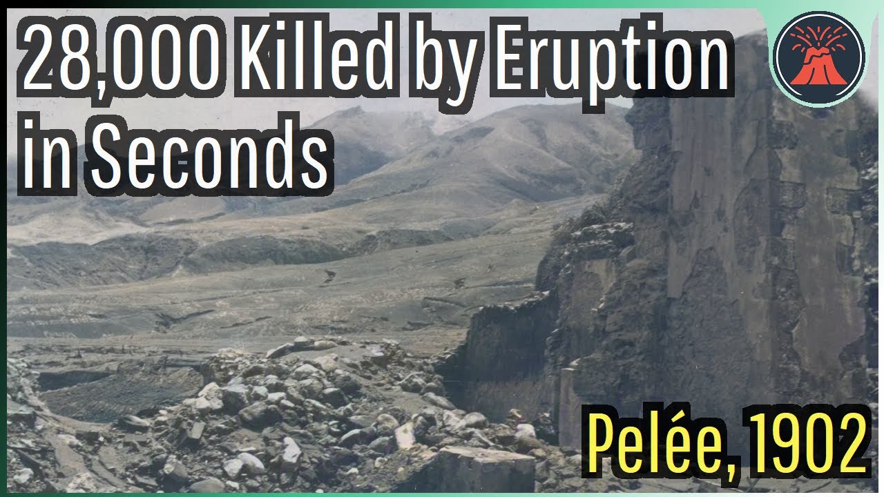
On May 8th 1902, 28,000 people along with the Caribbean's most prosperous city were wiped off the map. It only took 35 seconds. That is the amount of time it took for the advancing 1,000 degrees pyroclastic flows to completely destroy the city of Saint-Pierre. Yet, there were warning signs beforehand, and there are lessons that this disaster can tell us about preventing future tragedies.
Thumbnail Photo Credit: Public Domain in United States, {{PD-US}}, https://www.loc.gov/pictures/item/202.... Colorized with hotspot.ai commercial license credits. Note: The colorized image is not in the public domain, only the source black & white image. The GeologyHub logo, text, and GeologyHub graphics overlays are also not in the public domain.
Part 2: • Wiped Off the Map; Pelee's Infamous 1902 E...
Google Earth imagery used in this video: ©Google & Data Providers
This video is protected under "fair use". If you see an image and/or video which is your own in this video, and/or think my discussion of a scientific paper (and/or discussion/mentioning of the data/information within a scientific paper) does not fall under the fair use doctrine, and wish for it to be censored or removed, contact me by email at [email protected] and I will make the necessary changes.
Various licenses used in sections of this video (not the entire video, this video as a whole does not completely fall under one of these licenses) and/or in this video's thumbnail image (and this list does not include every license used in this video and/or thumbnail image):
Public Domain: https://creativecommons.org/publicdom...
CC BY 4.0: https://creativecommons.org/licenses/...
Sources/Citations:
[1] Volcanological and Seismological Observatory of Martinique (OVSM – IPGP)
[2] Mordensky, Stanley & Ruscitto, D. & Wallace, Paul & Cashman, Katharine. (2011). Magmatic volatiles and low Pressure degassing at a mafic shield volcano (Belknap) in the Oregon Cascades. AGU Fall Meeting Abstracts. 2665-. This source was used to cite the Belknap Crater volatile figures.
[3] Gregg Bluth, "Montagne Pelée, 1902", Michigan Technological University, GE4150 Lecture
[4] La catastrophe: the eruption of Mount Pelee, the worst volcanic eruption of the twentieth century. (2002). Choice Reviews Online, 40(04), 40–2183. https://doi.org/10.5860/choice.40-2183
[5] U.S. Geological Survey
[6] Edmund Otis Hovey, "The 1902-1903 eruptions of Mont Pele, Martinique, and the Soufriere, St. Vincent.", Congr. geol. intern., Compte rendu IX Sess., pp. 707-738, 11 pis. and 6 figs., 1904.
[7] Huebsch, M., Kueppers, U., Carazzo, G. et al. Fragmentation behavior of young pyroclasts from Mt. Pelée, Martinique. Bull Volcanol 85, 62 (2023). https://doi.org/10.1007/s00445-023-01..., CC BY 4.0. This source was used to cite the composition of Pelee's 1902 eruptive products.
[8] Gueugneau V, Kelfoun K, Charbonnier S, Germa A and Carazzo G (2020) Dynamics and Impacts of the May 8th, 1902 Pyroclastic Current at Mount Pelée (Martinique): New Insights From Numerical Modeling. Front. Earth Sci. 8:279. doi: 10.3389/feart.2020.00279, CC BY 4.0. This source was used to draw the pre-eruption outline of the town of Saint Pierre in 1902.
[9] VEIs, dates/years, composition, tephra layer name, DRE estimates, and bulk tephra volume estimates for volcanic eruptions shown in this video which were assigned a VEI 4 or larger are sourced from the LaMEVE database (British Geological Survey © UKRI), https://www2.bgs.ac.uk/vogripa/view/c..., Used with Permission
[10] Georges Boudon, Anne Le Friant, Benoit Villemant, Jean-Pierre Viode, "Martinique", Volcanic Hazard Atlas Of The Lesser Antilles, Observatoire Volcanologique et Sismologique de la Martinique.
[11] Mazabraud, Yves. (2019). Historical and Contemporary Use of Natural Stones in the French West Indies. Conservation Aspects and Practices. Sustainability. 11. 4566. 10.3390/su11174566., CC BY 4.0.
[12] Brown, S.K., Jenkins, S.F., Sparks, R.S.J. et al. Volcanic fatalities database: analysis of volcanic threat with distance and victim classification. J Appl. Volcanol. 6, 15 (2017). https://doi.org/10.1186/s13617-017-00..., CC BY 4.0.
Note: This database & paper were used to approximate the location of 1902 Pelee fatalities.
[13] Michaud-Dubuy, A., Carazzo, G. & Kaminski, E. Volcanic hazard assessment for tephra fallout in Martinique. J Appl. Volcanol. 10, 8 (2021). https://doi.org/10.1186/s13617-021-00..., CC BY 4.0.
[14] Pichavant, M., C. Martel, J.-L. Bourdier, and B. Scaillet, Physical conditions, structure, and dynamics of a zoned magma chamber: Mount Pelée (Martinique, Lesser Antilles Arc), J. Geophys. Res., 107(B5), doi:10.1029/2001JB000315, 2002. This source was used to cite the Pelee volcano volatile figures.
0:00 28,000 Lives Lost
1:29 Pelee Volcano Geology
4:19 Collapse Scars
6:47 Prior Eruptions
7:44 Early Warning Signs
8:42 Eruption Begins
10:09 Tragedy Strikes
12:59 Part 2 Release
Повторяем попытку...
Доступные форматы для скачивания:
Скачать видео
-
Информация по загрузке:


![Une ville française détruite par un volcan (8 mai 1902) [ST]](https://imager.clipsaver.ru/lfRS8-DYYHI/max.jpg)