Predicting Flood Extent with Rainfall Data | ArcGIS Pro Flood Simulation Tool
Автор: Geomatics Engineer
Загружено: 2025-12-07
Просмотров: 165
Описание:
Stop guessing, start modeling! In this step-by-step ArcGIS Pro tutorial, I'll show you exactly how to use the Flood Simulation tool to model potential flooding from a rainfall event. Whether you're in planning, engineering, environmental science, or just learning GIS, this skill is crucial for risk assessment and visualization.
We'll start from scratch:
What you need: Setting up your DEM (Digital Elevation Model) and preparing your rainfall data.
Key parameters explained: Demystifying the "Rainfall Volume," "Infiltration," and "Cell Size" inputs. What do they mean and how do you choose the right values?
Running the simulation: A walkthrough of the Flood Simulation geoprocessing tool in ArcGIS Pro.
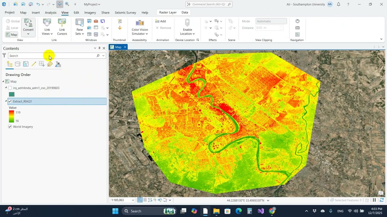
Interpreting the results: Understanding the "Flood Depth" and "Flood Water" raster outputs to map the inundation area and water depth.
Making it presentable: Styling your flood map for maximum clarity and impact in a layout.
Повторяем попытку...
Доступные форматы для скачивания:
Скачать видео
-
Информация по загрузке: