⁴ᴷ⁶⁰ Walking Brookline, MA: Coolidge Corner to Amory Park
Автор: Walking & Driving Incognito
Загружено: 2025-01-08
Просмотров: 741
Описание:
January 1, 2025 - 11:00 AM
47°F / 8°C
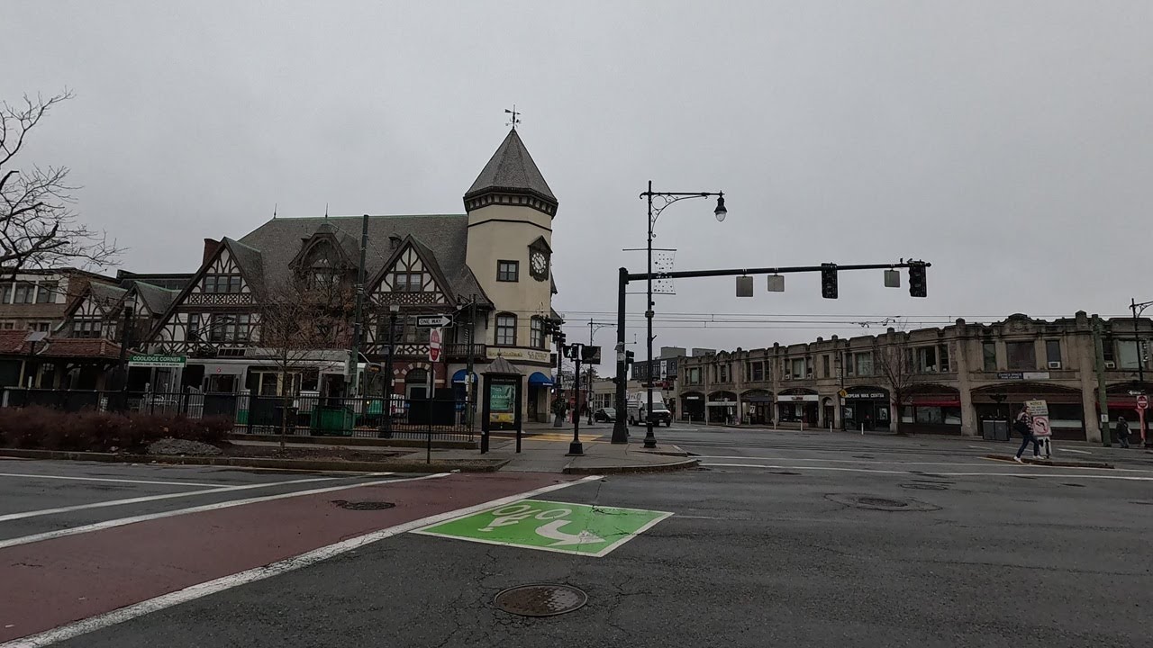
Walking (without narration) in Brookline, Massachusetts, from the Coolidge Corner business district to Amory Park via the following route: southbound on Harvard Street → westbound on Beacon Street → eastbound on Webster Street → northbound on Harvard Street → eastbound on Beacon Street → northbound on Powell Street → westbound on Parkman Street → northbound on St. Paul Street → Knyvet Square → Amory Park. (I originally wanted to end the walk inside the Hall's Pond Sanctuary, but it was unexpectedly closed)
Filmed with GoPro Hero 12.
Highlights:
00:00 - Walking southbound on Harvard Street
01:57 - Coolidge Corner Theatre
03:20 - The S.S. Pierce Building, walking westbound on Beacon Street
06:03 - Walking eastbound on Webster Street, Courtyard Boston Brookline
06:26 - Iris Hotel Boston
08:14 - Walking northbound on Harvard Street
10:35 - Walking eastbound on Beacon Street
16:53 - Temple Ohabei Shalom synagogue
18:02 - Wild turkeys at the Kent Street T stop
18:33 - Walking northbound on Powell Street
19:38 - Walking westbound on Parkman Street
21:37 - Walking northbound on St. Paul Street
25:33 - Knyvet Square
28:23 - Amory Park
From Wikipedia:
"Brookline is a town in Norfolk County, Massachusetts, United States, and part of the Boston metropolitan area. An exclave of Norfolk County, Brookline borders six of Boston's neighborhoods: Brighton, Allston, Fenway–Kenmore, Mission Hill, Jamaica Plain, and West Roxbury. The city of Newton borders Brookline to the west. It is known for being the birthplace of John F. Kennedy.
The land which comprises what is today Brookline was first settled in 1638 as a hamlet in Boston, known as Muddy River (as it was settled on the west side of the river of the same name). It was incorporated as a separate town with the name of Brookline in 1705. In 1873, Brookline had a contentious referendum in which it voted to remain independent from Boston. The later annexations of Brighton and West Roxbury, both in 1874, and that of Hyde Park in 1912, eventually made Brookline into an exclave of Norfolk County. The town has a history of racial discrimination in zoning, which has led to a disproportionately wealthy population and a very low percentage of Black residents, at only 2.5%.
Several streets and railroads were laid out in the town in the 19th century. Today, these are Massachusetts Route 9 (locally "Boylston St", which cuts the town in two) and the various branches of the MBTA's Green Line. To the north of Route 9, the area is fairly urban; the southern part is much less so.
At the time of the 2020 census, the population of the town was 63,191. It has been the most populous municipality in Massachusetts to have a town (rather than city) form of government since Framingham changed to a city in 2018, following a 2017 referendum."
Повторяем попытку...
Доступные форматы для скачивания:
Скачать видео
-
Информация по загрузке: