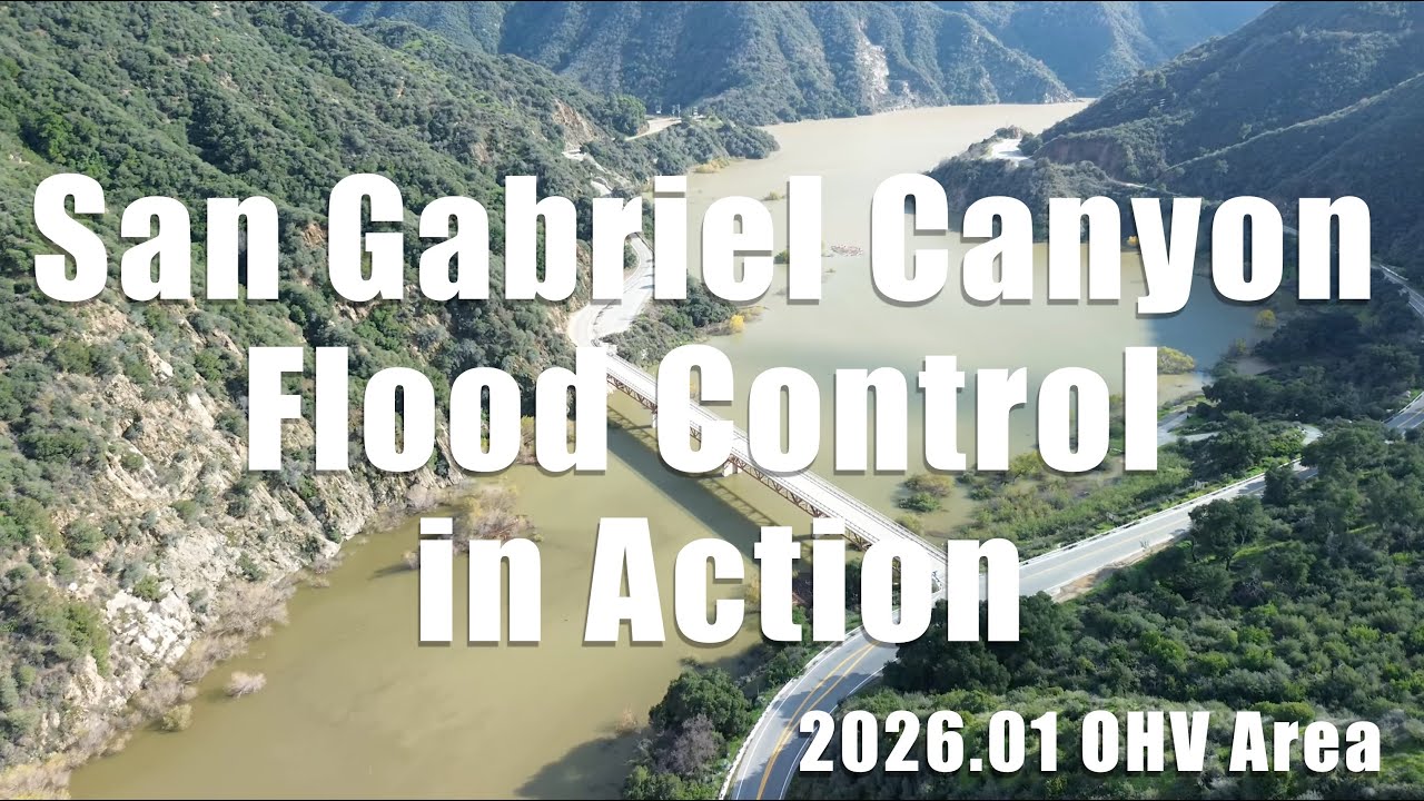
San Gabriel Canyon Flood Control – Works as Designed, San Gabriel OHV Area
Автор: SoCal Skywave
Загружено: 2026-01-10
Просмотров: 207
Описание:
Following winter storms in late 2025 and early 2026,
this video documents San Gabriel Canyon during active flood control operations in Los Angeles County, California.
The footage captures the San Gabriel River system shortly after storm events, when flood control reservoirs and channels are temporarily holding and releasing water as intended.
This state—periods of increased flow followed by drawdown—reflects the system operating as designed during and after winter storms.
Captured by drone, the video follows the river through the San Gabriel Canyon OHV Area, its three forks, and associated reservoirs and dams.
It records water movement, temporary storage, release patterns, sediment traces, and downstream flow beyond the canyon, providing a visual record of flood control infrastructure in action.
Locations featured:
– San Gabriel Canyon OHV Area
– West Fork, East Fork, and North Fork of the San Gabriel River
– Morris Reservoir and Morris Dam
– Santa Anita Dam and Reservoir
Recorded on January 7, 2026.
0:00 San Gabriel Canyon OHV Area
1:30 Bridge
2:20 San Gabriel Reservoir (from the Morris Reservoir side)
2:40 East Fork San Gabriel Canyon
3:08 Burro Canyon
6:00 West Fork San Gabriel River
7:50 North end of San Gabriel Reservoir
8:18 North Fork San Gabriel River
9:50 Graffiti tags along the river
13:00 West Fork San Gabriel River
14:50 Morris Reservoir
16:40 Morris Dam / Reservoir
17:00 The lower reaches of the San Gabriel River
21:40 Downstream beyond the canyon
23:10 Santa Anita Dam / Reservoir
2026.01.07
Повторяем попытку...
Доступные форматы для скачивания:
Скачать видео
-
Информация по загрузке:


![1172 [2025 Desert Trip] Big Morongo Canyon Preserve](https://image.4k-video.ru/id-video/AyMb4kbnsNk)