ycliper

Популярное

Музыка Кино и Анимация Автомобили Животные Спорт Путешествия Игры Юмор

Интересные видео

2025 Сериалы Трейлеры Новости Как сделать Видеоуроки Diy своими руками

Топ запросов

смотреть а4 schoolboy runaway турецкий сериал смотреть мультфильмы эдисон
Скачать

Tree Species Classification from Remotely Sensed Data: From Hyperspectral to RGB

Автор: IEEE GRSS

Загружено: 2025-12-08

Просмотров: 190

Описание: Tree Species Classification from Remotely Sensed Data: From Hyperspectral to RGB

11 April 2025

by Dr Matheus Pinheiro Ferreira
Universidade de São Paulo (USP), Department of Forest Sciences at the Luiz de Queiroz College of Agriculture, Brazil

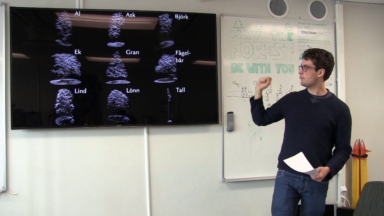
Tree species classification is crucial for managing and conserving highly diverse tropical forests. However, spatially explicit information on tree species distribution is typically limited to small-scale field inventories, making large-scale monitoring challenging. Remote sensing (RS) offers a powerful alternative, particularly very-high-resolution imagery (GSD ≤ 1 m), which enables species classification at the level of individual tree crown (ITC) level. Hyperspectral imaging have demonstrated the potential of fine spectral resolution for distinguishing tree species based on subtle biochemical and structural differences. More recently, deep learning, especially convolutional neural networks (CNNs), has emerged as a promising approach to automate tree species classification using ultra-high-resolution drone-acquired RGB images. Additionally, unsupervised deep learning methods are being explored to augment ITC datasets, addressing the challenge of scarce labeled data in tropical forests. In this talk, I will explore how different RS data sources—from hyperspectral to high-resolution RGB—can be leveraged to improve tree species classification in tropical environments. I will discuss recent advances in CNN-based classification and the role of unsupervised learning in enhancing ITC datasets.

Webinar sponsored by IEEE GRSS UK & Ireland Chapter

Не удается загрузить Youtube-плеер. Проверьте блокировку Youtube в вашей сети.
Повторяем попытку...
Tree Species Classification from Remotely Sensed Data: From Hyperspectral to RGB

Поделиться в:

Доступные форматы для скачивания:

Скачать видео

  • Информация по загрузке:

Скачать аудио

Похожие видео

Tree species classification with multispectral laser

Tree species classification with multispectral laser

High-dimensional Landscape Dynamics 2.0: mapping non-stand-replacing forest disturbance (Sentinel-2)

High-dimensional Landscape Dynamics 2.0: mapping non-stand-replacing forest disturbance (Sentinel-2)

11/6: Data Series: Data Collaboration and Governance

11/6: Data Series: Data Collaboration and Governance

Из почвы в жизнь: дистанционное зондирование критической зоны

Из почвы в жизнь: дистанционное зондирование критической зоны

Hyperspectral and Multispectral Imaging - TRENDING IN OPTICS

Hyperspectral and Multispectral Imaging - TRENDING IN OPTICS

Measuring Water in Forests Using Microwaves and Other Remote Sensing Techniques

Measuring Water in Forests Using Microwaves and Other Remote Sensing Techniques

Virtual Seminars

Virtual Seminars

Mafia w MSZ w czasie rządów PiS. Tomasz Szwejgiert, Jan Piński

Mafia w MSZ w czasie rządów PiS. Tomasz Szwejgiert, Jan Piński

Последовательное обучение и анализ временных рядов с использованием квантовых рекуррентных моделей

Последовательное обучение и анализ временных рядов с использованием квантовых рекуррентных моделей

Введение в многоспектральную визуализацию

Введение в многоспектральную визуализацию

TESSERA: Предварительно вычисленные глобальные пиксельные встраивания FAIR для представления и ан...

TESSERA: Предварительно вычисленные глобальные пиксельные встраивания FAIR для представления и ан...

Performing stand counts using multispectral data and index thresholding in QGIS

Performing stand counts using multispectral data and index thresholding in QGIS

AlphaEarth Foundations and the Satellite Embedding Dataset: A New Foundation for Geospatial Analysis

AlphaEarth Foundations and the Satellite Embedding Dataset: A New Foundation for Geospatial Analysis

Physics-Based Artificial Intelligence in Earth Observation

Physics-Based Artificial Intelligence in Earth Observation

POżyteczni idioci, szkodliwi cwaniacy

POżyteczni idioci, szkodliwi cwaniacy

Школа IADF 2025: Введение в GRSS

Школа IADF 2025: Введение в GRSS

REO workshop 2025: Michal Kazmierski – AlphaEarth Foundations: Better Maps Faster

REO workshop 2025: Michal Kazmierski – AlphaEarth Foundations: Better Maps Faster

NDVI & PRI Measurement Theory, Methods, and Applications

NDVI & PRI Measurement Theory, Methods, and Applications

Recent Advances in Geospatial Machine Learning

Recent Advances in Geospatial Machine Learning

Remote Sensing of Permafrost Vulnerability and Geohazards

Remote Sensing of Permafrost Vulnerability and Geohazards

© 2025 ycliper. Все права защищены.


  • Контакты
  • О нас
  • Политика конфиденциальности


Контакты для правообладателей: [email protected]