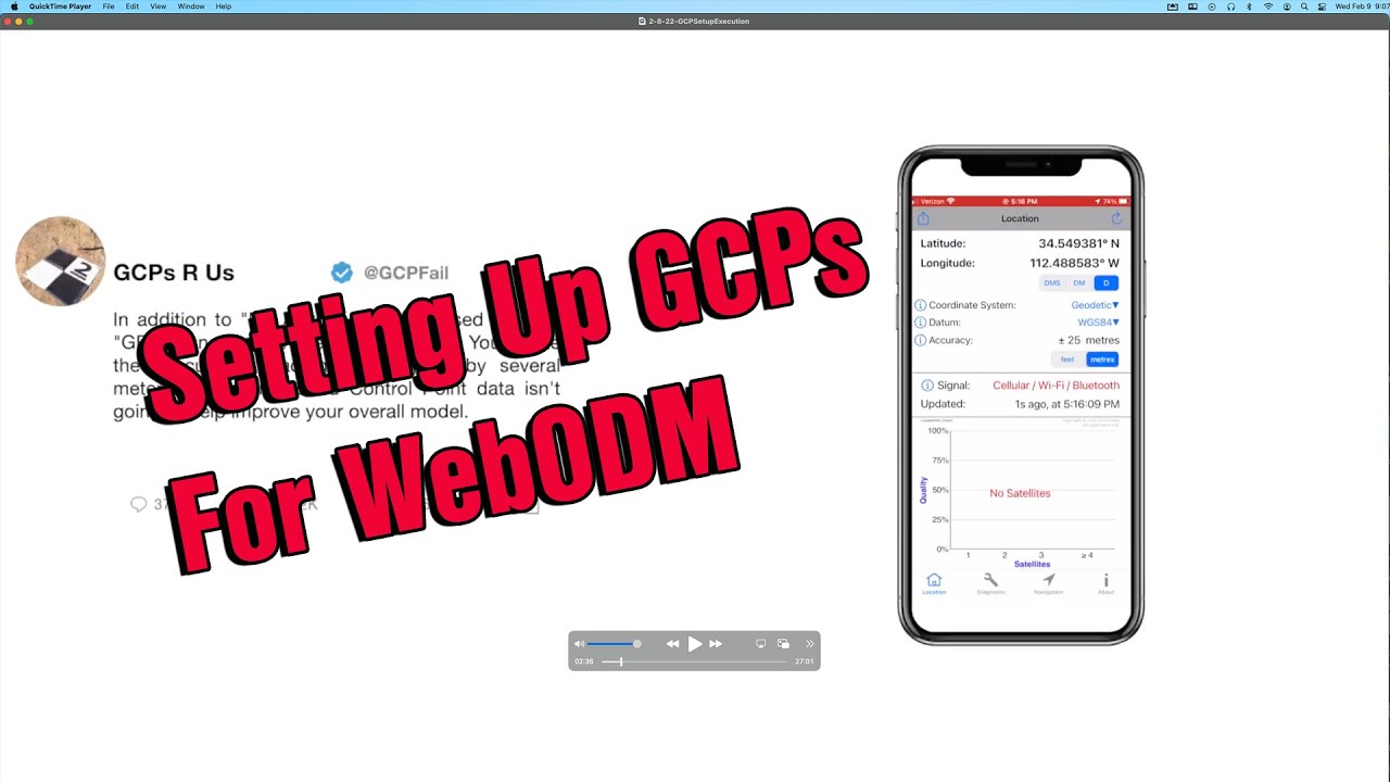
Setting Up GCPs For WebODM - An Imperfect Example
Автор: Rich Charpentier
Загружено: 2022-02-09
Просмотров: 11280
Описание:
In this video you'll join me in the field setting up several Ground Control Point targets for a small build site we're documenting. The setup isn't perfect as we're not using a mapping or survey grade GPS to mark the targets. The point of this video is to show you the process of capturing GCPs for your modeling efforts with WebODM.
We used a Mavic 2 Pro for this video, and an iPhone 8 with Map Pilot Pro, and an iPhone 8+ as our GPS. If you're serious about modeling and using Ground Control Points you'll be wanting a better GPS setup, or something like the Phantom 4 RTK unit.
00:20 Setting Ground Control Point Targets In The Field
01:54 Using iOS My Altitude App
02:25 Using GPSDiagnostic App
03:00 Flying the job site
03:38 Back in the office setting up
09:41 Setting up GCP text file
11:15 WebODM GCP tool
12:25 Importing the GCP text file
13:40 Matching images up to GCP map
20:32 Setting up images and GCPs for modeling
23:20 Checking out the 2D Model
Online Courses Help Support This Channel
We’ve launched our new Tutorials Platform at Teachable September of 2020. Check out our course offerings today! https://az-drone.teachable.com/courses For our YouTube followers we’re offering 40% off all non-bundled classes with the coupon “40PERCENT”. We’re also offering discounted bundled courses as well. What classes do we offer?
▪ 11 Class Bundle - https://tinyurl.com/2vx2kv63
▪ Beginners Guide To Map Pilot 2D and 3D Modeling Data Collection - https://tinyurl.com/y3hmxb4f
▪ Beginners DJI Ground Station Pro - https://tinyurl.com/y2h7g52n
▪ Drone Construction Progression Reporting - https://tinyurl.com/y3tebxsj
▪ Litchi Waypoint Missions For Your Drone Business - https://tinyurl.com/y5txjtmx
▪ Introduction To 2&3D Drone Modeling With Agisoft Metashape - https://tinyurl.com/y5yet6qn
▪ Drone 3D Modeling For Beginners - Low Cost Solutions - http://bit.ly/2MLX78r
▪ Post Part 107 Class - Building Your Drone Business - http://bit.ly/3cTR4sX
▪ Drone Photography and Image Editing For Beginners - http://bit.ly/2MEBSpc
▪ Lightroom Workflow Digital Photography Management. http://bit.ly/3jw8a1j
▪ Beginners guide to making 360 Virtual Tours With Kuula - http://bit.ly/2LKFkOq
▪ Beginners Ricoh Theta Z1 Class - https://az-drone.teachable.com/p/begi...
Become a Patreon Member Today - / richcharpentier
The Gear I use:
•DJI Mavic 2 Pro - https://amzn.to/2LFWet8
•DJI Mavic Pro - https://amzn.to/2CFuXnK
•Canon 5D Mark II - https://amzn.to/2RmIwk6
•Canon 7D - https://amzn.to/2CFrVzG
•Sony a5100 - https://amzn.to/2CFFG1y
•DJI Osmo Mobile 2 - https://amzn.to/2VpjbFw
•Blue Yeti USB Mic - https://amzn.to/2Ru5ypv
Follow me on Instagram at:
/ livingintin
Like the music tracks on this channel?
Click below to visit Soundstripe, where we get all of our audio tracks!
https://soundstripe.grsm.io/RichardCh...
Looking to support this channel so I can provide more mobile tech and mobile living videos? Feel free to make a donation to the channel through Paypal: https://paypal.me/RichardCharpentier
Повторяем попытку...
Доступные форматы для скачивания:
Скачать видео
-
Информация по загрузке: