Exploring the Power of ArcGIS Pro for Simulating Water Flow and Flood Dynamics
Автор: M.ALKAMEL
Загружено: 2025-08-08
Просмотров: 544
Описание:
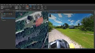
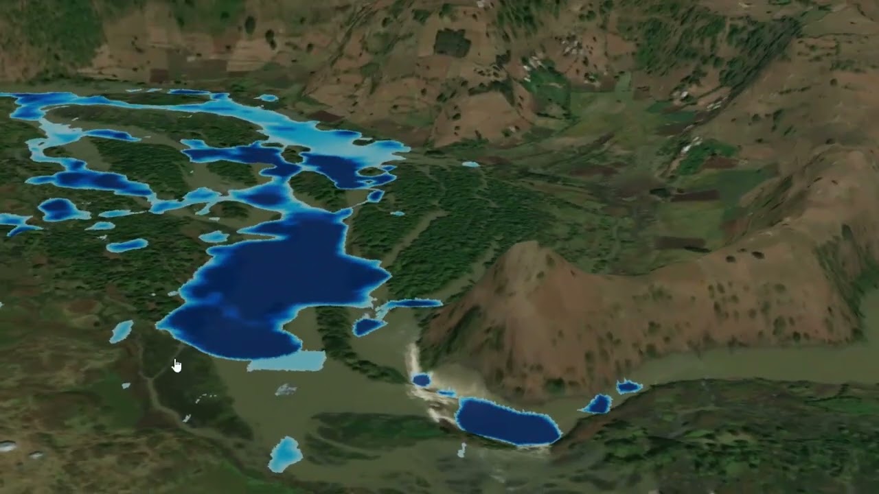
I recently created this sample simulation (using non-real data) to demonstrate how water behaves in stream valleys during high discharge events. Although the data isn't real, the visual result was so compelling that I felt drawn to share it with you.
The simulation models water velocity and potential flooding using hashtag#ArcGIS Pro - a powerful tool for hydrological and terrain-based analysis.
The scene represents the Ethiopian Highlands near Lake Tana, the source of the Blue Nile - a place of incredible geographic and environmental significance.
GIS is more than just mapping - it's a way to visualize, understand, and communicate natural processes in powerful and meaningful ways.
Thanks to Esri - gistec for making this visual experience possible
#arcgispro #watersimulation #floodmodeling #hydrology #LakeTana #bluenile #geospatialanalysis #giscommunity
Повторяем попытку...
Доступные форматы для скачивания:
Скачать видео
-
Информация по загрузке: