Archicad - Project a Satellite Image onto Your 3D Terrain (Realistic Ground Texture)
Автор: TopoExport
Загружено: 2025-07-27
Просмотров: 445
Описание:
👉 TopoExport : https://topoexport.com/
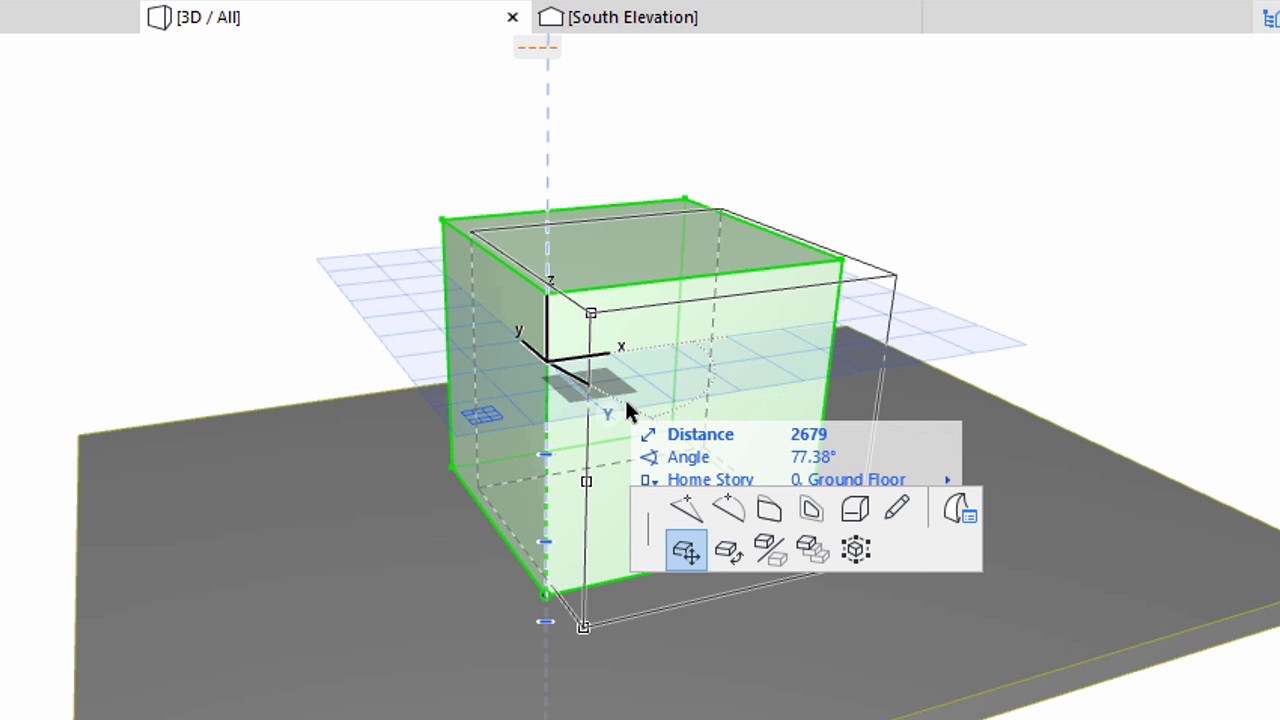
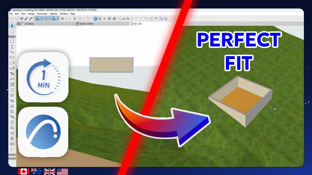
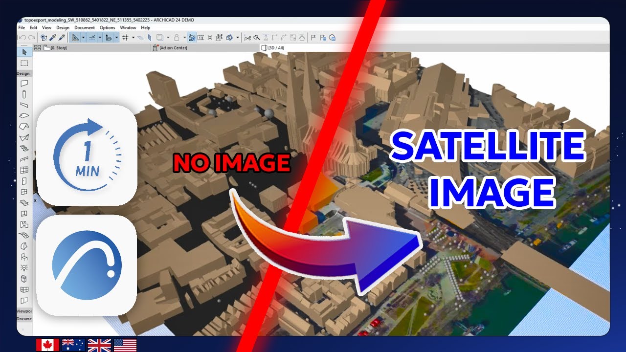
In this Archicad tutorial you’ll learn how to project a satellite image onto a 3D terrain mesh to give your model a realistic geo-referenced texture. The DXF and image files used in this video come from TopoExport.com your go to source for 3D terrain vector layers and matching satellite imagery.
This tutorial covers:
Changing the building surface materials
Aligning and scaling a satellite image in a worksheet
Creating a custom surface material with the image texture
Applying the texture to a 3D terrain mesh for realistic rendering
Ideal for architects landscape designers and urban planners who want visually accurate site models with aerial imagery.
👉 TopoExport : https://topoexport.com/
📷 Instagram : / topoexport
🎵 TikTok : / topoexport
👔 LinkedIn : / topoexport
📌 Pinterest : https://www.pinterest.fr/topoexport/
✉️ E-mail : [email protected]
#topoexport #archicad26 #archicad25 #Archicad #CAD #BIM #Architectural #UrbanPlanning #TopographicModel #ArchicadTutorial #CityModel
Повторяем попытку...
Доступные форматы для скачивания:
Скачать видео
-
Информация по загрузке: