Indian Map में PoK, Aksai Chin को US Trump Administration ने कैसे दिखाया? Pakistan, China तिलमिलाए
Автор: The Lallantop
Загружено: 2026-02-07
Просмотров: 53690
Описание:
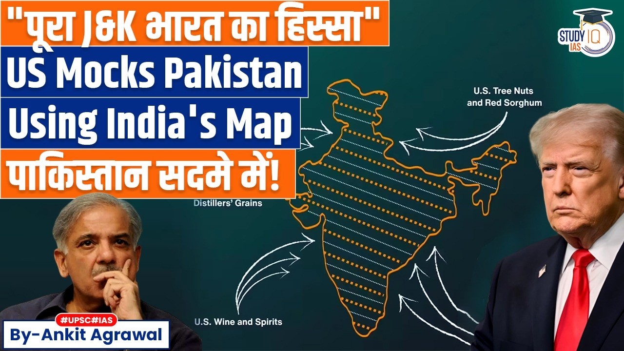
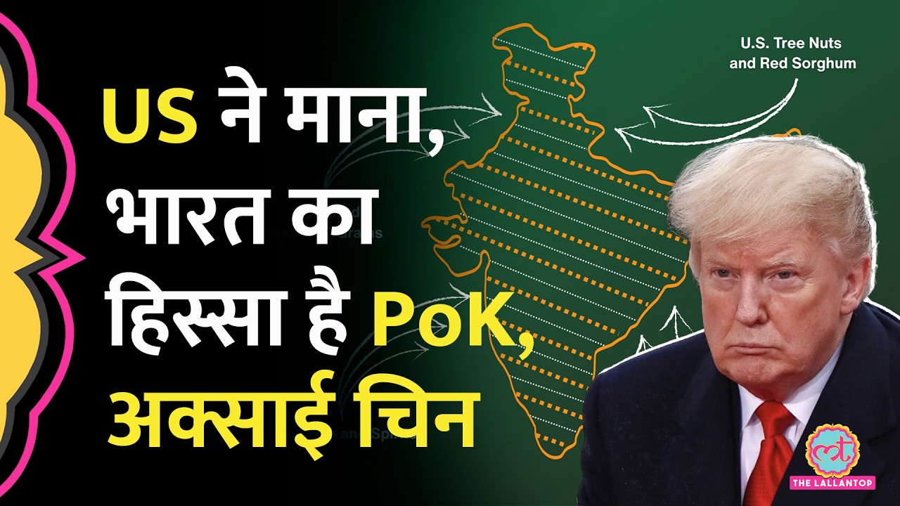
A new US map released alongside the India–US Trade Deal framework has quietly delivered a big diplomatic message: it shows Pakistan Occupied Kashmir (PoK) and Aksai Chin entirely inside India’s borders, aligning Washington’s cartography with New Delhi’s official map just as the new 18% tariff regime kicks in. While India has always maintained that Jammu & Kashmir, including PoK and Aksai Chin, are integral parts of the country, earlier US maps had typically “fudged” these areas to reflect Pakistani and Chinese claims; Trump’s administration now appears to have junked that ambiguity at the very moment it signs an interim trade agreement that cuts punitive tariffs from 50% to 18%. The move has triggered heartburn in Islamabad, where Army chief Asim Munir’s repeated US visits suddenly look ineffective, and unease in Beijing, even as Indian officials and commentators hail the map as a diplomatic win that strengthens India’s position on sensitive border issues and symbolically underlines that the new India–US partnership will be built on New Delhi’s full territorial claims rather than “disputed” overlays, Watch the Full Video Now!
The copyright ownership in the video rests with India Today Group. No third party is permitted to use the video without obtaining the permission of India Today Group. Any permission for usage can be obtained through the email ID provided here: [email protected].
न्यूज़ लेटर के लिए क्लिक करें : https://www.thelallantop.com/newsletter
खबरों को विस्तार से पढ़ने के लिए क्लिक करें यहां : https://www.thelallantop.com/
Instagram: @thelallantop
Facebook: @thelallantop
Twitter: @TheLallantop
Production: Naved
Video Editor: Alok Pandey
Повторяем попытку...
Доступные форматы для скачивания:
Скачать видео
-
Информация по загрузке: