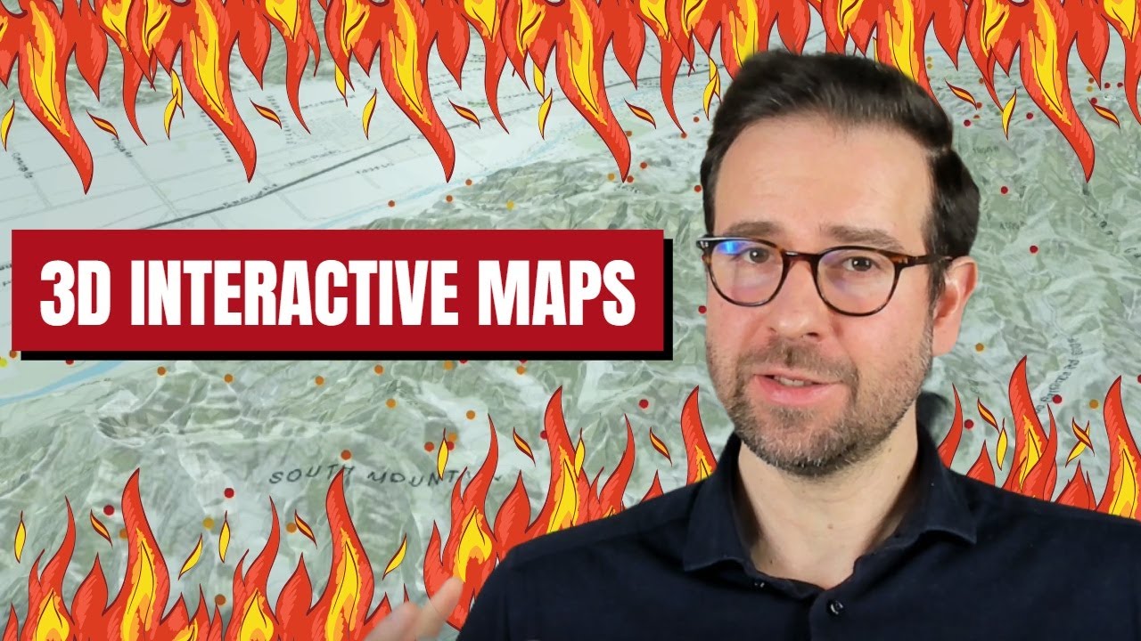
Elevate Your GIS Skills: Make FREE 3D Interactive Maps with R Using Mapbox GL JS & NASA FIRMS Data!
Автор: Milos Makes Maps
Загружено: 2024-12-16
Просмотров: 2377
Описание:
Learn how to master the art of creating free 3D interactive maps with R using Mapbox GL JS in R. Explore fire event visualization with NASA FIRMS fire data and take your GIS skills to the next level with this tutorial!
What You'll Discover:
1️⃣ How to skillfully prepare and format texture and elevation data for a stunning 3D terrain map.
2️⃣ How to effortlessly integrate NASA FIRMS fire events into your map for a specific location and timeframe.
3️⃣ Insider tips for supercharging your maps with interactive and advanced visualization techniques.
🚀 By the end, you'll have a stellar, functional 3D map that showcases real-world fire data-perfect for presentations, reports, or personal projects. 💡 Why Choose Mapdeck? Mapdeck combines R, Mapbox, and Deck.gl, creating an incredible library for interactive maps. This tutorial simplifies it all, showing you how to unleash its potential with just a few lines of code.
🔗 Resources Mentioned:
Full code in my GitHub repo: https://github.com/milos-agathon/3d-d...
Earthdata registration: https://urs.earthdata.nasa.gov/ NASA FIRMS data: https://firms.modaps.eosdis.nasa.gov/...
Mapdeck documentation: https://deck.gl/docs/api-reference/ge...
💬 Got questions or suggestions? Share them in the comments! I can't wait to hear how you're using 3D terrain maps.
🟠Follow me on Instagram: / milos_makes_maps
⚫️Connect on X: / milosmakesmaps
🔵Follow me on BlueSky: https://bsky.app/profile/milos-makes-...
☕️If you enjoy my work, consider buying me a coffee: https://www.buymeacoffee.com/milospop...
🔔 Don’t Miss Out:
Subscribe to Milos Makes Maps for more tutorials on GIS, geospatial analysis, and R programming. Hit the like button if this video inspires you, and share it with your fellow GIS enthusiasts!
Повторяем попытку...
Доступные форматы для скачивания:
Скачать видео
-
Информация по загрузке: