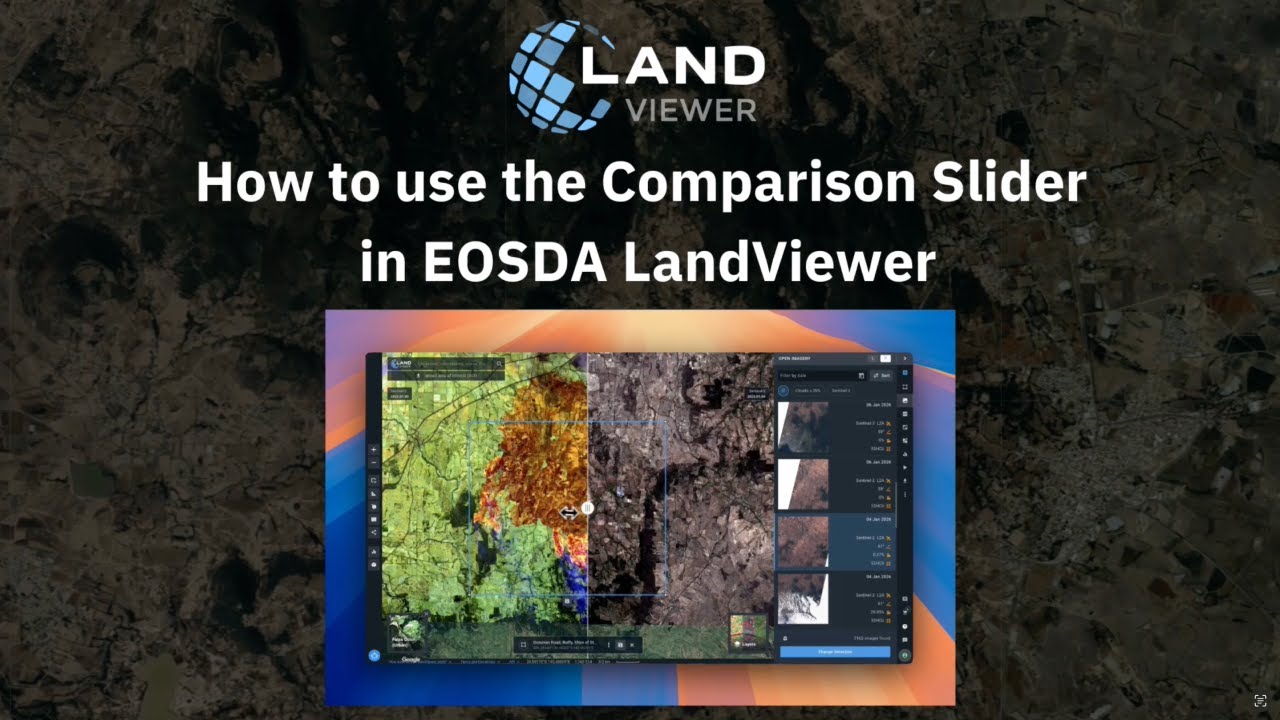
High resolution imagery in EOSDA LandViewer
Автор: EOSDA LandViewer
Загружено: 2025-12-08
Просмотров: 91
Описание:
EOSDA LandViewer is connected to Airbus SE via API, therefore you can preview high-res satellite images, select the one that fits your AOI most and purchase it. The procedure is as follows:
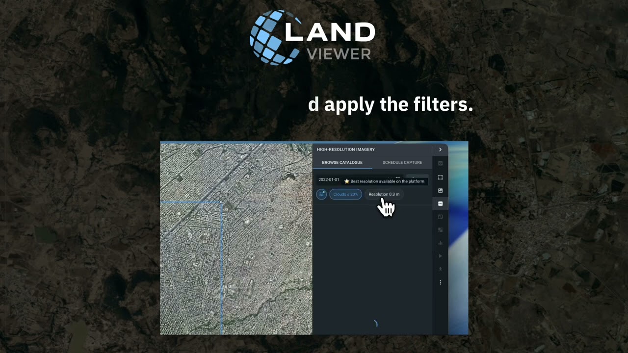
Set the AOI and select High resolution imagery (for analytics) category in the Source drop-down menu of All Filters tab. Apply the other filters.
Preview the available scenes on the map and check the details. The price is given in US dollars and highlighted in green. It also provides you with the information about the area of intersection between the selected image and your AOI the final price is based on. In other words, the larger the area of intersection, the higher the price charged. Select the necessary images and click Add to cart.
Our website — https://bit.ly/42BY6w0
🔹 Facebook: / eosdalandviewer
🔹 Instagram: / eosda_landviewer
🔹 LinkedIn: / eosda-landviewer
Повторяем попытку...
Доступные форматы для скачивания:
Скачать видео
-
Информация по загрузке: