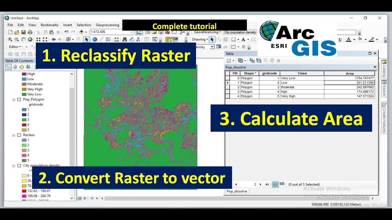
Reclassify and convert Raster to vector and calculate area using ArcGIS expanded
Автор: Geojay GIS Solution
Загружено: 2025-02-14
Просмотров: 1542
Описание:
#arcgis #raster #reclassify #area @TerraSpatial
Reclassifying raster data in ArcGIS is a valuable process that transforms continuous data into categorical classes, simplifying analysis and interpretation. This step allows users to focus on specific features, such as land cover types or elevation ranges. Converting reclassified raster data into polygons further enhances usability, enabling easier manipulation and visualization. Calculating the area of these polygons is crucial for quantifying spatial characteristics, supporting decision-making in urban planning, environmental management, and resource allocation. By integrating these processes, users can derive meaningful insights from complex datasets, facilitating effective communication of results and fostering informed strategies for land use and environmental conservation. This video shows how to reclassify raster, convert to polygon and calculate the area in ArcGIS. Enjoy watching and subscribe
raster to vector, reclassify and convert raster to polygon using arcgis, raster to polygon, how to calculate area in arcgis, how to calculate raster area in arcgis, raster to shapefile, reclassify,how to calculate area in arcmap, extract raster values to shapefile, how to calculate area from raster & vector in arcmap, how to reclassify raster data, raster, convert raster to vector, how to calculate area from vector, area calculation, how to calculate area from raster, geojay, gis
Buy me a coffee: https://buymeacoffee.com/geojay
For business and enquiries: WhatsApp+2347065365193 or Email: [email protected]
TikTok: https://www.tiktok.com/@geojaygissolu...
Twitter/X: / geojay_gis
Subscribe for more videos:
/ @geojaygissolution4856
Related videos
Reclassify and Convert Raster to Polygon Shapefile and calculate area: • Reclassify and Convert Raster to Polygon S...
Raster and factors reclassification for site suitability analysis in ArcGIS: • Raster and factors reclassification for si...
Повторяем попытку...
Доступные форматы для скачивания:
Скачать видео
-
Информация по загрузке: