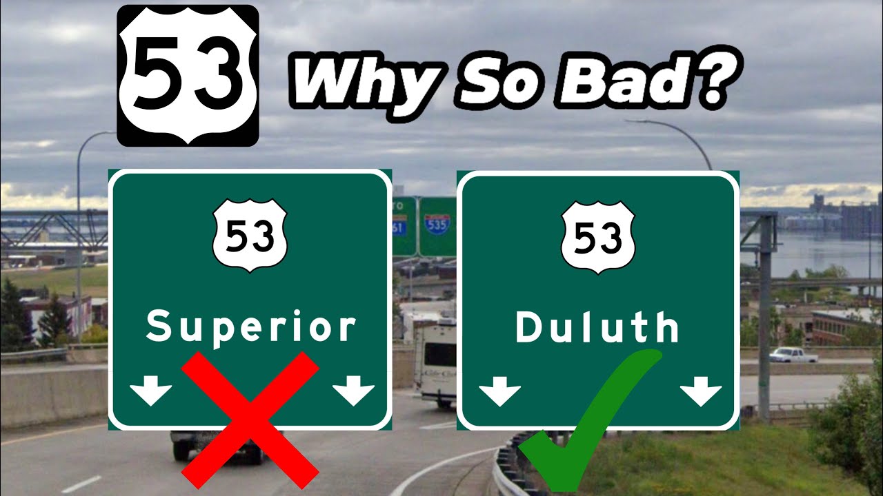
Why are Wisconsin Control Cities so Bad? | U.S. 53 Control Cities!
Автор: Extreme Geography
Загружено: 2024-08-31
Просмотров: 1140
Описание:
Why are Wisconsin Control Cities so Bad?
From Wikipedia:
“U.S. Route 53, or U.S. Highway 53 (U.S. 53), is a north–south U.S. highway that runs for 404 miles (650 km) from La Crosse, Wisconsin to International Falls, Minnesota. It is the primary north–south route in northwestern Wisconsin, serving as a vital link between I-94 at Eau Claire, Wisconsin and the Twin Ports of Superior, Wisconsin, and Duluth, Minnesota. The entire route from Eau Claire to the city limits of Superior is a four lane divided highway. The highway's northern terminus is at the Fort Frances–International Falls International Bridge in International Falls, Minnesota, at the Canada–US border. Its southern terminus is in La Crosse, Wisconsin, at U.S. Highway 14.”
Wikipedia Page: https://en.m.wikipedia.org/wiki/U.S._...
All Photos from Google Earth unless Stated Otherwise
In today’s video I cover another U.S. Highway, this being U.S. 53, and how bad Wisconsin Control Cities are, they range from being plain out bad, inconsistent, and provincial
Enjoy The Video!!!
Main Channel: @ExtremeJay_
Second Channel: @ExtremelyJay_
Geography Discord: / discord
My Discord (not Geography): / discord
Twitch: / omittedjay
@arnathanroads ‘s U.S. 2 and 63 Videos:
U.S. 2 Eastern: • US 2 Eastern: A New England Masterpiece
U.S. 63 Northbound: • US-63 North: Actual Decent Signage in Miss...
U.S. 63 Southbound: • US-63 South: A New Side of ARDOT
Timestamps:
Intro: 0:00
Wisconsin (Northbound): 0:11
Minnesota (Northbound): 3:21
Minnesota (Southbound): 4:41
Wisconsin (Southbound): 5:12
What The Control Cities Should Be: 6:45
Outro: 7:33
#usa #us #highways #wisconsin #minnesota #lacrosse #eauclaire #duluth #duluthmn
Повторяем попытку...
Доступные форматы для скачивания:
Скачать видео
-
Информация по загрузке: