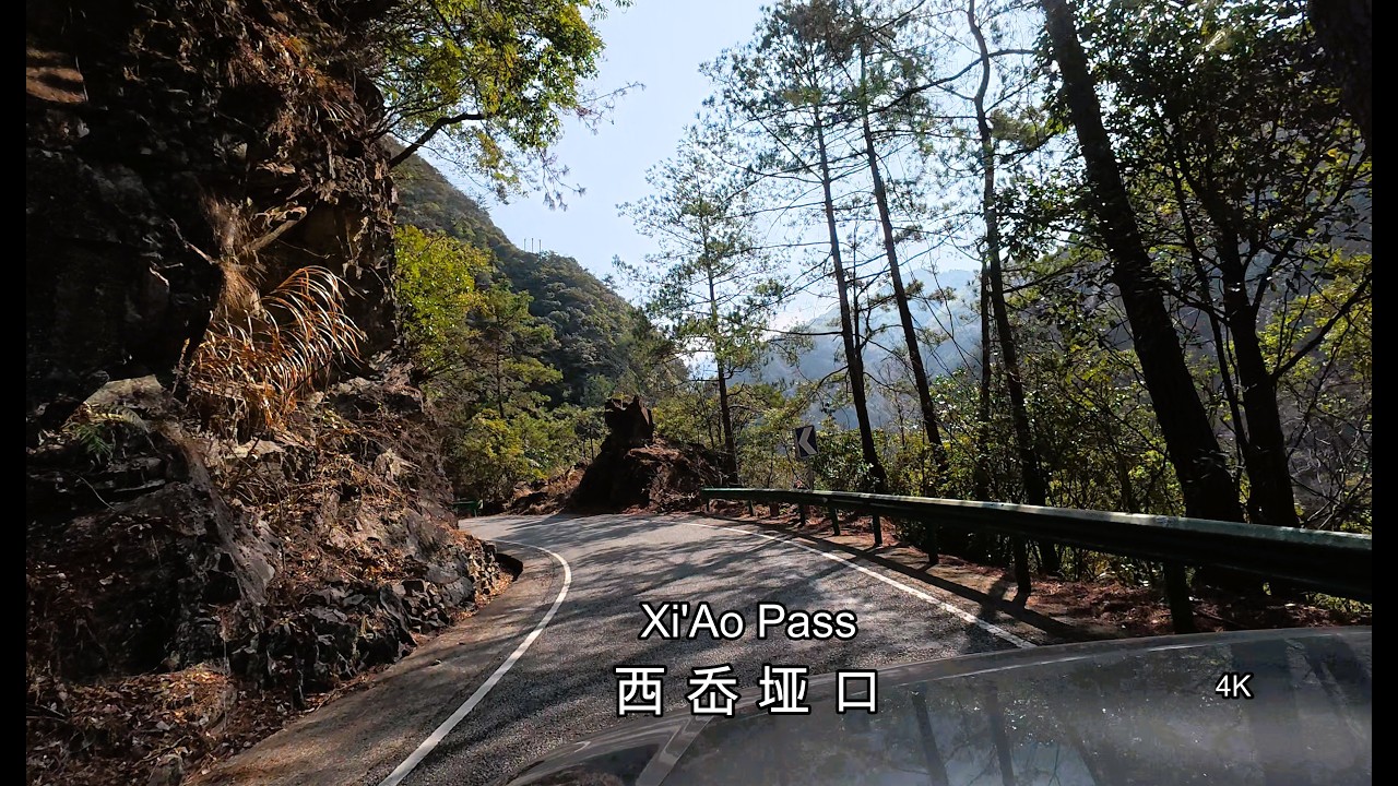
Crossing The Xianxia Mountains Remote roads in Zheijiang China
Автор: Eberhard Ritzau Driven by nature
Загружено: 2026-02-10
Просмотров: 75
Описание:
A 4K drive across the remote Xianxia Mountains in southern Zhejiang, crossing Xi’Ao Pass and some of the highest terrain in the province.
Narrow mountain roads, deep valleys, and authentic landscapes — far from the tourist routes.
Zhejiang Province in eastern China is characterized by a predominantly mountainous and hilly terrain, with mountains covering roughly 70% of its land area, most of them formed around 120 million years ago.
The Xianxia Mountains are a major, high, and rugged mountain range in southern Zhejiang. They form an important watershed and are clearly separated from Fujian’s Wuyi Mountains by the Song River valley.
The three highest peaks of Zhejiang Province are all located within this mountain range:
• Huangmao Peak – 1,929 m
• Mount Baishanzu – 1,857 m
• Longquan Mountain – 1,848 m
With an elevation of 1,249 m, Xi’Ao Pass is the highest mountain pass in the region, although several small side roads climb up to nearly 1,400 m. Fully exploring the Xianxia Mountains would easily take two weeks or more.
This drive follows the X104 Anyu Line (marked as X803 on Google Maps), leading from Lanyu (Longquan) over Xi’Ao Pass into the very remote Jingning She Autonomous County.
The roads are generally in very good condition but are narrow, steep, and extremely curvy, often running along exposed cliffs. Careful driving and frequent honking at blind corners are highly recommended.
The landscape is of extraordinary beauty, although this journey still shows traces of dry winter vegetation. The region has a warm, humid subtropical climate, and nature begins to fully explode in March.
Up to the pass, the road passes through the Baishanzu Nature Reserve, where encounters with Tibetan macaques are possible. Please be aware that these monkeys can be quite aggressive when begging for food.
Driving date: 2026-02-01
________________________________________
Best time to drive
Recommended:
• March / April
• September to December (dry weather)
Avoid:
• May to September – heavy rain, Typhoons, and increased risk of rockfalls
• Chinese public holidays – heavy traffic and crowded scenic areas
Serious Warning!
The Mountains are not far from the coast and Zheijiangs coast is prone to Typhoon landfalls from June to October
Besides heavy downpour, sometimes hail, wind over 100km/h is regular during Typhoons. This means you have not only a high rockfall risk, also treefalls and broken branches are common.
________________________________________
Accommodation
• Small homestays are available near the Pass as well as Longquan and Baishanzu scenic areas
(foreigners are usually not accepted)
• Atour Hotel, Longquan – highly recommended for Western travelers
________________________________________
Route
Google Maps (driving route):
https://www.google.com/maps/dir/Lanju...
Timeline
00:00 preview
00:50 Countryroad X104
01:18 Taoist Temple
01:55 Entering the Longquan Canon
04:50 Drone clip from river bed
07 :00 big workdrone in the air
07:35 junction to scenic areas
08:25 the real “X “ level” roadsize starts
09:20 getting steeper and narrow
11:10 the along the cliff - don’t miss
13:55 picture – view back into the valley
17:07 “Winter vegetation”at the cliff
21:26 “Ruoliao”- mountain village
25:00 “Huangmaojian” in clouds
26:15crossing X Ao Pass
28:18 “Huangcun”- remote mountain village
31.35 cliffroad again
35:33 nice gate to “She Autonomous County’
Повторяем попытку...
Доступные форматы для скачивания:
Скачать видео
-
Информация по загрузке:


![ドライブ動画#69 [割と難所]宮城県道・福島県道102号平松梁川線を完全走破](https://imager.clipsaver.ru/coJ10WnchfI/max.jpg)