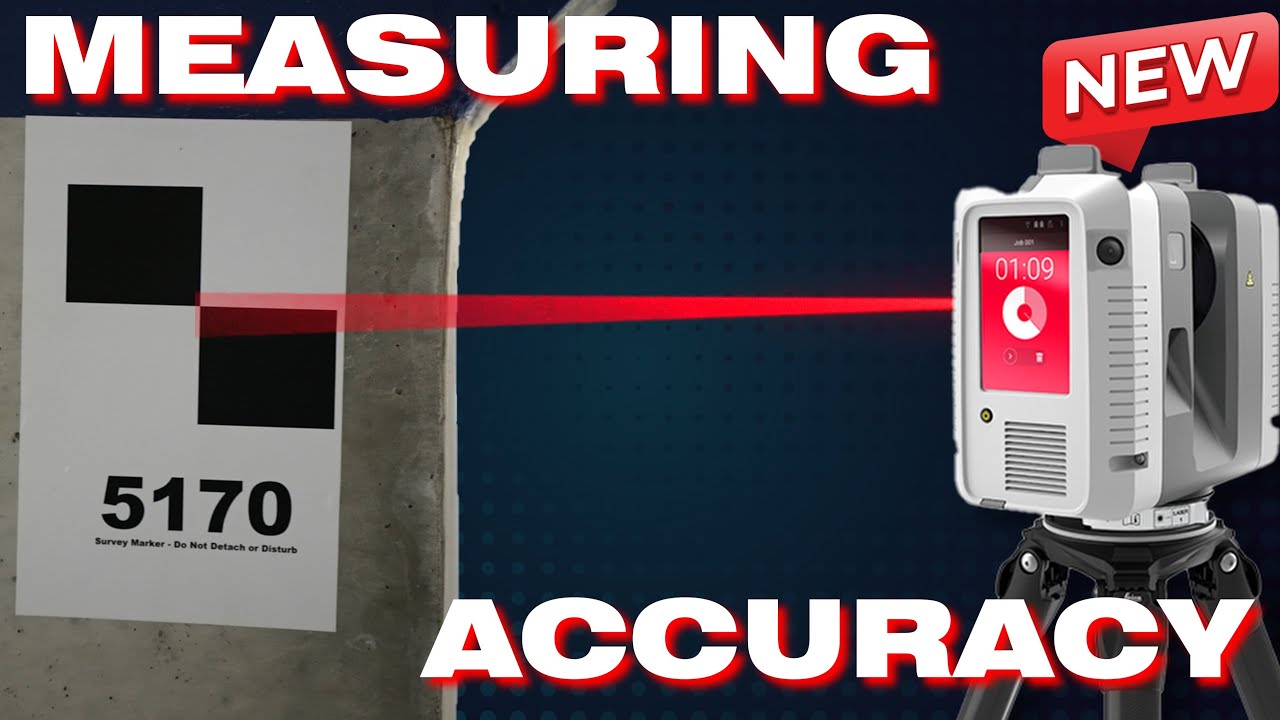
Measuring Point Cloud Accuracy - 1 Dimensional Method
Автор: The 3rd Dimension
Загружено: 2025-05-12
Просмотров: 3091
Описание:
Download Link:
https://1drv.ms/f/c/409a77fcc169e845/...
In the above link there is a metric & imperial version. Both have sample data inside of them that you will need to delete before using your own data.
Video Description:
Unlock the secrets to accurately measuring point cloud accuracy in 3D scanning with the innovative One-Dimensional Method! If you work in land surveying, construction, or reality capture and struggle with unreliable accuracy metrics from registration software, this video is for you. Learn how to leverage survey control for more reliable, efficient, and transparent point cloud accuracy assessments-perfect for projects using LiDAR, photogrammetry, or SLAM.
In this step-by-step guide, we’ll compare traditional accuracy measurement workflows with a new, streamlined approach that:
Reduces field and office time
Increases the density and flexibility of check shots
Eliminates the need for excessive physical targets
Avoids the pitfalls of manual digitization errors
You’ll see practical demonstrations using tools like total stations, N4ce, and CloudCompare. Discover how to:
Set and code check shots efficiently
Use perpendicular surfaces for optimal results
Extract and compare 1D distance vectors between point cloud and control data
Visually inspect and validate your point cloud for blunders and errors
Download the FREE accuracy reporting workbook to automate your analysis with graphs, scatter plots, histograms, and more!
Whether you’re a surveyor, BIM specialist, or point cloud technician, mastering this method will help you deliver more reliable data to your clients and reduce costly mistakes.
Don’t forget to like, comment, and subscribe for more advanced surveying and 3D scanning tutorials!
Keywords: point cloud accuracy, 3D scanning, land surveying, LiDAR, photogrammetry, SLAM, survey control, accuracy measurement, N4ce, CloudCompare, quality control, construction, BIM, total station, one-dimensional method, accuracy reporting, free workbook
00:00 - Intro
03:21 - Current Methodology
10:18 - 1D Method - Field Capture
14:13 - Digitization
21:37 - The Workbook
33:25 - Final Thoughts
Повторяем попытку...
Доступные форматы для скачивания:
Скачать видео
-
Информация по загрузке: