Dudh Koshi Journey दुधकोशी नदी || Aerial tour of Doodh Kashi River || Dudh Kashi *Virtual
Автор: Namaste World
Загружено: 2021-05-22
Просмотров: 69693
Описание:
Dudh Koshi Journey दुधकोशी नदी || Aerial tour of Doodh Kashi River || Dudh Kashi *Virtual
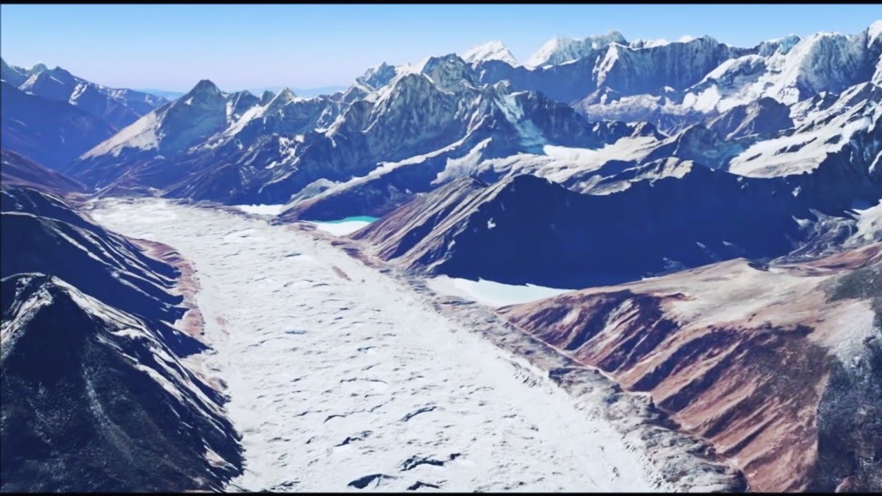
Dudh Koshi दुधकोशी नदी is a river in eastern Nepal. It is the highest river in terms of elevation. The river drains the Mount Everest massif, the highest peak in the world. It begins just east of Gokyo Lakes and flows south to Namche Bazaar. Continuing south, the Dudh Koshi exits Sagarmatha National Park and passes to the west of Lukla. The Lamding Khola joins the Dudh Koshi to the southwest of Surkya and continues its southerly course to Harkapur, where it joins the Sun Kosi.
Koshi river system
The Kosi River, or Sapt Koshi, drains eastern up. It is known as Sapta Koshi because of the seven rivers which join together in east-central Nepal to form this river. The main rivers forming the Sapta Koshi River system are – the Sun Koshi (सुन कोशी)], the Indravati River (इन्द्रावती), the tama Koshi (तामा कोशी), the Dudh Koshi (दुध कोशी), the Arun River (अरुण), Tamor River (तमोर) and Likhu River. The Dudh Kosi river originates from the high-altitude areas of Mount Everest (8848 metres) and the snow and glacier melt contributes significant portion of streamflow, especially during the dry season. The combined river flows through the Chatra Gorge in a southerly direction to emerge from the hills.
Повторяем попытку...
Доступные форматы для скачивания:
Скачать видео
-
Информация по загрузке:

![🇮🇳Reality of 80% of India ] India's Most Populated Cities And Villages [ Real India](https://imager.clipsaver.ru/g9fPEEnpiW4/max.jpg)