Python: Solving Large Transportation Analysis Problems
Автор: Esri Events
Загружено: 2019-04-03
Просмотров: 7342
Описание:
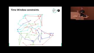
Solving large problems can be slow and memory intensive. For example, how do you find the three closest clinics for millions of patients or calculate a drive-time polygon around every store in your chain without waiting forever or running out of memory? This session will discuss how to solve large network analysis problems efficiently, including using Python to split the problem into smaller chunks and run the analysis in parallel on a single machine running ArcGIS Pro or on many machines that are part of an ArcGIS Server site or using directions and routing services available with ArcGIS Online.
--------------------------------------------------------------------------------------------------------------------------
Follow us on Social Media!
Twitter: / esri
Facebook: / esrigis
LinkedIn: / esri
Instagram: / esrigram
The Science of Where: http://www.esri.com
Повторяем попытку...

Доступные форматы для скачивания:
Скачать видео
-
Информация по загрузке: