ycliper

Популярное

Музыка Кино и Анимация Автомобили Животные Спорт Путешествия Игры Юмор

Интересные видео

2025 Сериалы Трейлеры Новости Как сделать Видеоуроки Diy своими руками

Топ запросов

смотреть а4 schoolboy runaway турецкий сериал смотреть мультфильмы эдисон
Скачать

Airborne Electromagnetic data - mapping mineral and groundwater resources

Автор: GeoscienceAustralia

Загружено: 2019-03-21

Просмотров: 53013

Описание: 
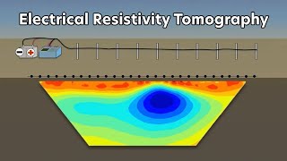
A movie highlighting the world’s largest airborne electromagnetic survey in the Northern Territory and Queensland. The new geoscience data has been collected by Geoscience Australia’s Exploring for the Future program, in partnership with the Northern Territory and Queensland geological surveys.
A total of 60,000 line kilometres of data were acquired over 2017 and 2018. Providing new insights into mineral-rich areas in Northern Australia that have not been extensively explored. This new research will enable government, the exploration industry and the research community to better understand the mineral potential of northern Australia.

ga.gov.au/eftf

Не удается загрузить Youtube-плеер. Проверьте блокировку Youtube в вашей сети.
Повторяем попытку...
Airborne Electromagnetic data - mapping mineral and groundwater resources

Поделиться в:

Доступные форматы для скачивания:

Скачать видео

  • Информация по загрузке:

Скачать аудио

Похожие видео

Electrical Resistivity Tomography: Imaging Sub-Surface Structures

Electrical Resistivity Tomography: Imaging Sub-Surface Structures

Bill Brown: Using Airborne Geophysics to Map Groundwater

Bill Brown: Using Airborne Geophysics to Map Groundwater

Massive Anomaly | IP Geophysics Report | Gold Exploration Dave Gamble (IMR)

Massive Anomaly | IP Geophysics Report | Gold Exploration Dave Gamble (IMR)

Using An Autonomous eBee Drone For Mining Exploration

Using An Autonomous eBee Drone For Mining Exploration

How Do You Perform Magnetic Surveys with Drones? - Key Considerations

How Do You Perform Magnetic Surveys with Drones? - Key Considerations

Groundwater

Groundwater

Почему железным дорогам не нужны деформационные швы

Почему железным дорогам не нужны деформационные швы

Drone Mapping For Minerals

Drone Mapping For Minerals

Новый Диаметр Москвы — трамваи заменят метро!

Новый Диаметр Москвы — трамваи заменят метро!

MagArrow and Perimeter X8 UAV for UAV-Magnetics

MagArrow and Perimeter X8 UAV for UAV-Magnetics

Australian Fundamental Gravity Network: Shaping the network for our future needs

Australian Fundamental Gravity Network: Shaping the network for our future needs

UAV Magnetics UNR Geothermal Energy Research

UAV Magnetics UNR Geothermal Energy Research

Mineral Exploration Geologist

Mineral Exploration Geologist

Что такое LiDAR-съемка с помощью дронов? Точность и результаты

Что такое LiDAR-съемка с помощью дронов? Точность и результаты

Interpreting aeromagnetic data to aid mapping undercover and structural analysis of the Tanami

Interpreting aeromagnetic data to aid mapping undercover and structural analysis of the Tanami

In-depth 3D IP GOLD Geophysical Analysis (TSX.V: BMK) MacDonald Mines Ltd.

In-depth 3D IP GOLD Geophysical Analysis (TSX.V: BMK) MacDonald Mines Ltd.

2.2 Hydrology and Hydraulics

2.2 Hydrology and Hydraulics

Как электростатические двигатели нарушают все правила

Как электростатические двигатели нарушают все правила

Geologists explain why Tasmania is different

Geologists explain why Tasmania is different

Introducing geophysical surveying

Introducing geophysical surveying

© 2025 ycliper. Все права защищены.


  • Контакты
  • О нас
  • Политика конфиденциальности


Контакты для правообладателей: [email protected]