Data Collaboration and Conflation: California Road Sharing (CaRS) | On-Demand MYM 2026
Автор: National States Geographic Information Council
Загружено: 2026-02-09
Просмотров: 12
Описание:
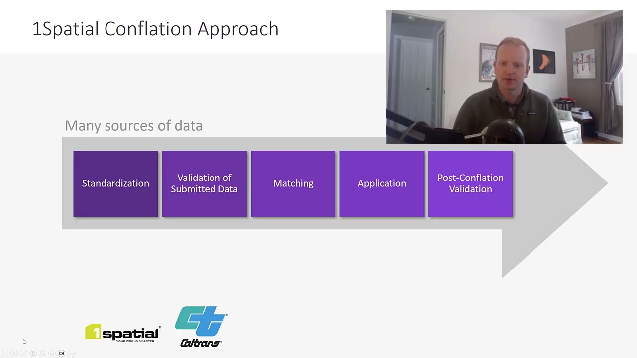
Accurate statewide roads data is essential for everything from emergency response to transportation planning. In this session, Caltrans’ Aaron Ott and 1Spatial’s Luke Winters demonstrate how California is strengthening its statewide road network by automating conflation between NG9‑1‑1 datasets and the state’s ARNOLD network. You’ll see how this collaboration improves data accuracy, streamlines updates across jurisdictions, and directly supports Vision Zero safety goals. Better roadway data leads to smarter safety investments—and ultimately fewer incidents and reduced demand on NG9‑1‑1 call centers.
NSGIC exists to advance effective national coordination of geospatial information by supporting state-level cooperation. We serve as a national forum for the development of capable and future-oriented geospatial leadership.
Learn more at https://nsgic.org
Повторяем попытку...
Доступные форматы для скачивания:
Скачать видео
-
Информация по загрузке: