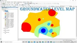
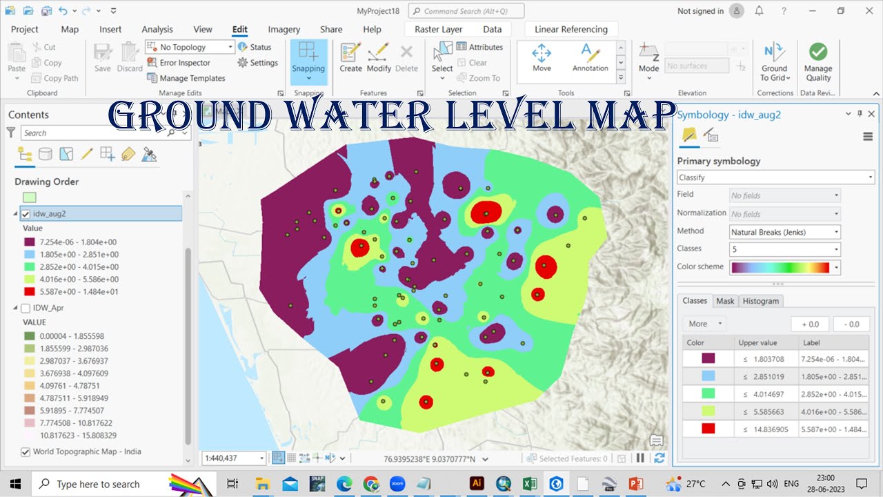
How to create Ground water level map or Depth to water level map using ArcGIS Pro
Автор: Vikas Ghadamode
Загружено: 2023-06-28
Просмотров: 14200
Описание:
In this Video we will learn How to prepare Ground water level map or Depth to water level map using Arcgis Pro.
Groundwater level is a term that is used in a relatively loose way, normally referring to the level, either below ground or above ordnance datum, at which soil or rock is saturated. This is also referred to as the water table and represents the top of the saturated zone.
Join our telegram Group Remote Sensing & GIS Professionals:- https://t.me/joinchat/UhUorR2yhloKeKP...
Any Help Contact
Mr.Vikas [email protected]
WhatsApp Number= +918421031398
WhatsApp Chat:https://wa.me/+918421031398
Geotech GIS Training institute is a prestigious remote sensing training institute in India. Our vision is to bring an opportunity to every aspirant who dreams of a successful career in remote sensing and GIS field.
We conduct the following courses:
Training Program Related to Project Work- Duration- 1 Month
Basics of Remote Sensing and GIS - Duration- 3 Months
Advance Diploma in Remote Sensing and GIS - Duration- 6 Months
PG Diploma in Remote Sensing and GIS- Duration- 1 Year
Master of Remote Sensing and GIS - Duration: 2 Years
You May Like
Population Density Data: https://www.census2011.co.in/census/s...
Diva GIS Shapefile: https://www.diva-gis.org/gdata
RS & GIS QA15- Download ready-to-use contour lines from Open DEM & Generate DEM from Contour: • RS & GIS QA15- Download ready-to-use conto...
Land Use Land Cover Mapping in QGIS: • Land Use Land Cove (LULC) Mapping using QG...
How to Download Landsat 9 Data set from USGS earth Explorer: • How to Download Landsat 9 Data set from US...
Download Rainfall data: • Download rainfall data from CHRS Data Portal
Google earth Playlist : • Google Earth Hands On
ArcGIS : • ARC GIS
QGIS: • QGIS Lesson
Tags,
Water Level Map, Ground water level map, depth to water level map, IDW, Interpolation, conversion degree minute second to degree decimal, excel data add in Arcgis
Повторяем попытку...
Доступные форматы для скачивания:
Скачать видео
-
Информация по загрузке: