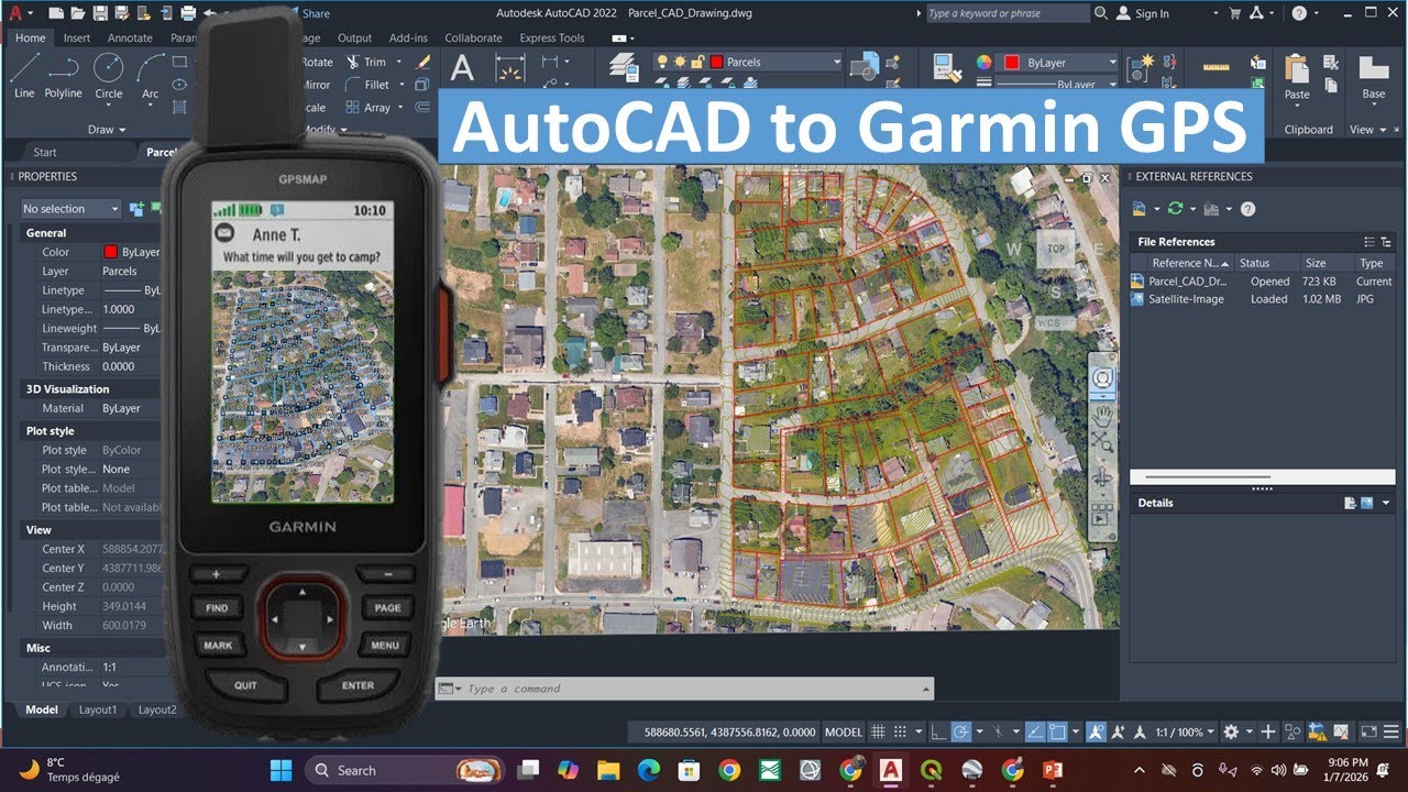
AutoCAD to Garmin GPS | Export ONE Layer Only (QGIS)
Автор: Made 4 Geek
Загружено: 2026-01-07
Просмотров: 347
Описание:
DWG/DXF to GPX | Export a Single AutoCAD Layer for Garmin GPS:
In this tutorial, you will learn how to export ONLY ONE layer from an AutoCAD drawing and send it to a Garmin GPS using QGIS .
Many users turn off layers in AutoCAD, but when exporting to GPX in QGIS, all layers appear again . This video explains why this happens and shows the correct method using WBLOCK to isolate a single layer before exporting.
What you will learn:
Why turning off layers in AutoCAD does NOT work
How to isolate one layer using LAYISO
How to export a single layer using WBLOCK
How to convert DXF to GPX in QGIS
Correct QGIS settings for Garmin GPS
Повторяем попытку...
Доступные форматы для скачивания:
Скачать видео
-
Информация по загрузке: