Water Quality Mapping in ArcGIS: IDW vs. Kriging Interpolation Techniques
Автор: Mr J&K Tech
Загружено: 2024-03-26
Просмотров: 342
Описание:
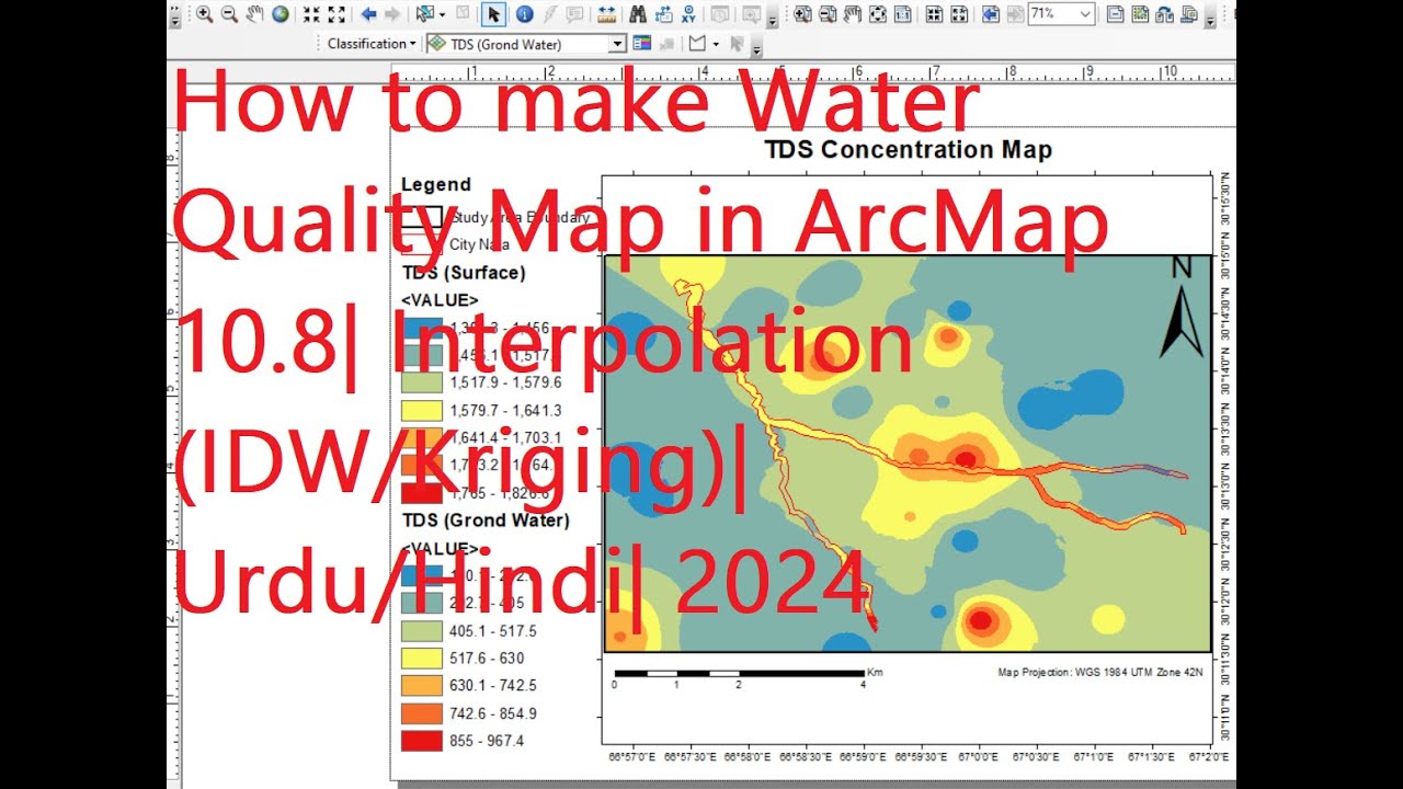
Dive into the world of water quality mapping with our comprehensive tutorial! In this video, we'll show you how to create stunning water quality maps using ArcGIS interpolation techniques, specifically IDW and Kriging. Learn step-by-step how to harness the power of these methods to visualize water quality data with precision and accuracy. Plus, we'll conduct a thorough comparison between IDW and Kriging results, giving you valuable insights into their strengths and limitations. Whether you're a GIS enthusiast or a seasoned professional, this video has everything you need to elevate your water quality mapping skills. Watch now and unlock the secrets of effective spatial analysis in ArcGIS
#waterquality
#arcgis
#idw
#kriging #interpolation n
#spatialanalysis analysis
#gistutorial #tutorial l
#analysis
#gis #comparison
#geospatial #technology y
#datavisualization #visualization #howto #foryou #arcmap #gistutorial #remotesensing #research #groundwater #surfacewater #spatialanalysis #spatialdata #tutorialforbeginners #mapping #utm #urdu #hindi #howto #environmentalscience #project
#projection
Повторяем попытку...
Доступные форматы для скачивания:
Скачать видео
-
Информация по загрузке: