Скачать
Using Custom Base Maps in Climate Engine
Автор: Climate Engine Org
Загружено: 2025-10-20
Просмотров: 111
Описание:
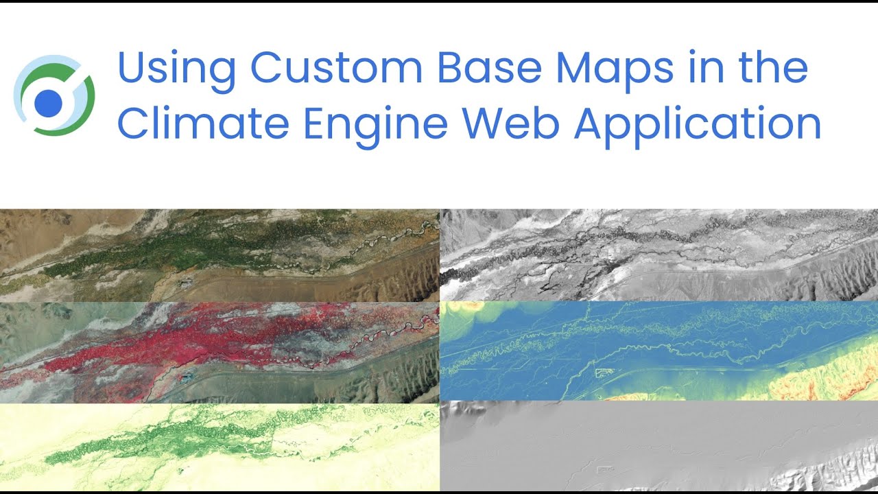
This short demo video highlights how to use Custom Base Maps in Climate Engine to assess vegetation changes related to a wildfire in Great Basin National Park in Nevada, USA in 2016. Historical imagery is used to visualize forest change prior to the wildfire and high resolution imagery from the USDA NAIP program is used assess the wildfire impacts alongside Climate Engine computed layers.
#Wildfire #GoogleEarthEngine #Geospatial #EarthObservations #RemoteSensing
Не удается загрузить Youtube-плеер. Проверьте блокировку Youtube в вашей сети.
Повторяем попытку...
Повторяем попытку...
Доступные форматы для скачивания:
Скачать видео
-
Информация по загрузке: