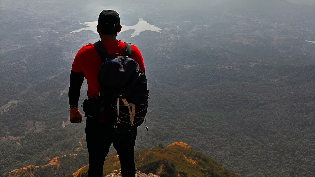
Chanderi Fort Trek, Panvel
Автор: ToWardsSahydri
Загружено: 2023-01-08
Просмотров: 826
Описание:
Chanderi Fort is situated near Thane in Badlapur region of Maharashtra. Chanderi Fort has its history in oblivion. But this actually is not a fort as there are no fortifications but there are water cisterns, caves and rock cut steps denoting it as a fort. This region was captured by Shivaji Maharaj from Mugals and later went to British. The route to this fort is extremely difficult which makes this fort as military base or hideout. The caves and rock cut steps are similar to ones on Kalavantin or Gorakhgad. This fort provides excellent view of all the surrounding forts making it as a vantage point or watch tower in those days. One can see Prabalgad, Kalavantin, Irshalgad, Karnala, Nakind, Vikatgad, Matheran, Mhaismal, Haji Malang, Tavli, Navra Navri and on far behind the Western Ghats.
The peculiar shape of Chanderigad is distinct and can be easily seen from anywhere. It looks like a table top. The top part or pinnacle is highly weathered due to high heat and cool rains making rocks fall frequently. Along side is another 4 pinnacle named Mhaismal or Mhasmal. These two are seperated from the Khind or col which is the lowest point. The Khind itself is around 470m above sea level where as the caves of Chanderi is around 800 850m. While the top part of the pinnacle is around 700m or more.
Trek to Chanderi starts from two villages. Either from Tamsai (Panvel) or from Chinchavli (Vangani, Badlapur). Route from Chinchavli is longer than compared to Tamsai. But Chinchavli is easily accessible and close to railway station. Village is small so parking for four wheeler should be done just before the village aside the road.
Chanderi is an indomitable fort. This hill is notorious for making its trekkers getting lost in dense deep jungles and rivulets earlier. But frequent trekkers have marked arrows and piled rocks to indicate direction. So just follow the arrows and you will be in top in no time. Don't worry about getting lost, just follow the arrows and rock piles. I myself got lost 3 times as i climbed the wrong river, explored a bit and found out my way as there are chances to miss sign. However if one does not want to take any chance you can hire guide from village.
The climb is gradual till huge plateau with lots of rocks and boulders. After this plateau the climb is via nalichi wat or river route till the Khind mentioned earlier. The climb is tiring as one has to cross boulders in summer while it will be refreshing in monsoon.
Once you reach the Khind the other side route is to Tamsai, Panvel. The left is to Chanderi. After the Khind there is further climb to the caves.
The route to Chanderi Caves is exposed to winds.
The caves are medium sized with idol of Shiva kept inside. The villagers gather here during Mahashivratri to perform ceremonies. Also trekkers can night hault here and cook food. But many leave waste behind making the caves look dirty. The cave also has a water cistern aside providing drinking water (cannot be sure due to much waste around it). Also there is another water cistern on the other side of hill.
Many trekkers travel till caves and return. One can also climb the pinnacle part till top where there is statue of Shivaji Maharaj from the other end of the hill.
#youtube #filmorago #goproindia #blogger #hikingadventures #panvel #raigad #chanderifort #maharashtra #sahyadri #gadkille
Повторяем попытку...
Доступные форматы для скачивания:
Скачать видео
-
Информация по загрузке: