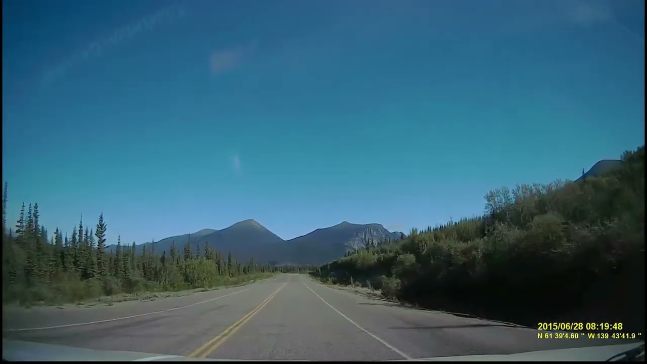
20150628 Day 21, Video: Travelling the Alcan's Burwash Landing to Beaver Creek, Yukon, Highway 1
Автор: ColoradoGeorge
Загружено: 2025-07-18
Просмотров: 21
Описание:
Intro:
This video complements the enhanced 4k resolution photo slideshow of segments of our Alcan Highway trip on the 28th of June 2015:
• 20150628, Day 21 Photo Slideshow Alcan Hwy...
Synopsis:
Sunday, 28 June 2015. Nadine & I (along with our two dogs, Bogie and Bridgette, a miniature and toy poodle) traveled along the Alcan Highway (Hwy 1) towing a 25' RV trailer from Cottonwood Park to Burwash Landing, Beaver Creek, and on into the port of entry, USA, enroute to Tok, AK, USA . These are but a few of the hundreds of snapshots and videos taken along the way...
During the summer months you'll find a lot of construction going on...repairing the road from the previous winter's destruction, getting ready for the next winter season. You may notice that while the Alcan Highway starts off with lots of promise for a reasonable trip...the road soon turns into a real nightmare!
Pretty much all of the tourist-oriented photos of Alaska include lots of sunshine and clear skies. I would suggest that there's a reason the south-eastern parts of Alaska consists of rain forests, receiving as much as 200" of rain a year, while Alaska's interior may receive up to 13" a year. We encountered equally as much sunshine as we did heavy overcast weather during our trip.
From Wikipedia:
The Alaska Highway (French: Route de l'Alaska; also known as the Alaskan Highway, Alaska-Canadian Highway, or ALCAN Highway) is a highway in North America which was constructed during World War II to connect the contiguous United States to Alaska through Canada. It begins at the junction with a few Canadian highways in Dawson Creek, British Columbia, and runs to Delta Junction, Alaska, via Whitehorse, Yukon. When it was completed in 1942, it was about 2,700 kilometers (1,700 mi) long, but in 2012, it was only 2,232 km (1,387 mi). This is due to the realignments of the highway over the years, which has rerouted and straightened many sections. The highway opened to the public in 1948. Once legendary for being a rough, challenging drive, the highway is now paved over its entire length (note: it is STILL a challenging drive!). Its component highways are British Columbia Highway 97, Yukon Highway 1, and Alaska Route 2.
An informal system of historic mileposts developed over the years to denote major stopping points. Delta Junction, at the end of the highway, makes reference to its location at "Historic Milepost 1422". It is at this point that the Alaska Highway meets the Richardson Highway, which continues 155 km (96 mi) to the city of Fairbanks. This is often regarded, though unofficially, as the northwestern portion of the Alaska Highway, with Fairbanks at Historic Milepost 1520. Mileposts on this stretch of highway are measured from the port of Valdez on Prince William Sound, rather than the Alaska Highway.
Filename: 20150628 Day 21, The Alcan-Burwash Landing to Beaver Creek, Yukon_1_thf4_hyp1_20250717-1248.mp4
Повторяем попытку...
Доступные форматы для скачивания:
Скачать видео
-
Информация по загрузке: