🚨Models are LOCKING IN on where the Heaviest Snow will be for our upcoming BLIZZARD
Автор: Storm Front Freaks Network with StormCat5
Загружено: 2026-02-21
Просмотров: 3209
Описание:
🚨Models are LOCKING IN on where the Heaviest Snow and Strongest Winds will be with our upcoming Bomb Cyclone BLIZZARD.
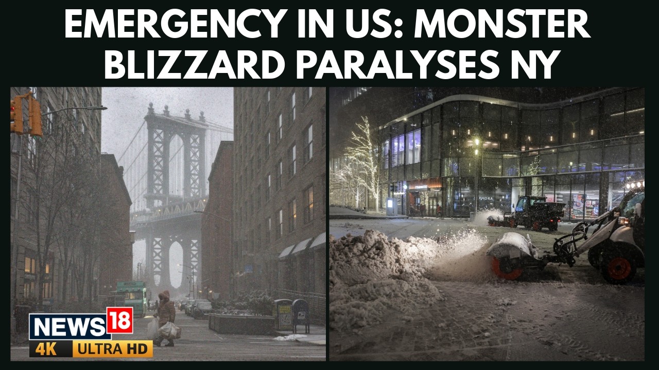
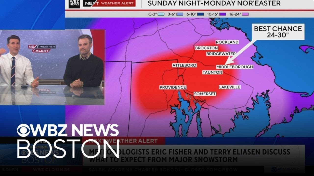
✅ Every Weather Model is now on board with a DUMPING of snow across the Coastal Northeast, with some spots getting close to 2 FEET!
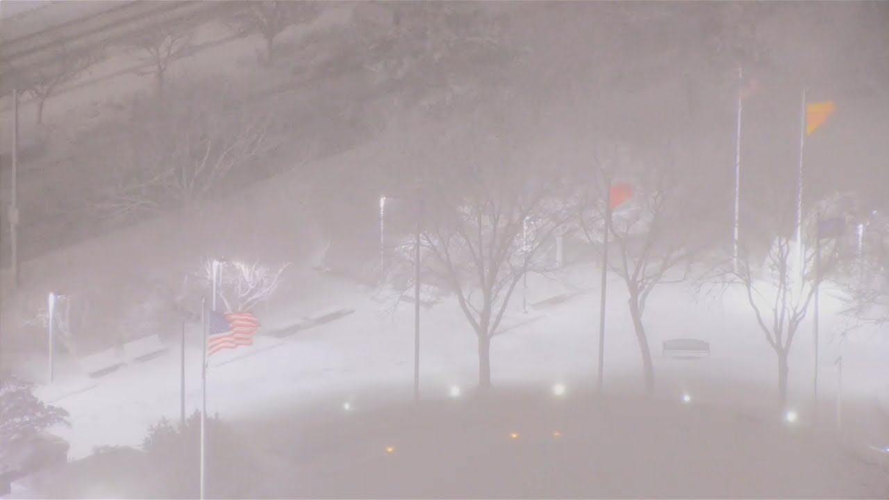
❄️ The highest Snow Totals will fall closest to the Coast in from Delaware up through New Jersey into long island and up into New England. This is where 12-20" of Snow is LIKELY.
🎯 Cities like Dover, Philadelphia, New York, Long Island, Newport, and even Boston will see Blizzard conditions Sunday night into Monday as snow piles up and winds really start to CRANK.
⚠️The National Weather Service is also on board and has even issued BLIZZARD WARNINGS from Atlantic City up through Long Island.
💨Wind Gusts from this Storm will gust near HURRICANE FORCE, creating near WHITEOUT Conditions during the height of the Storm Sunday night and Monday.
➡️⬅️ There is still time for small east or west shifts, but each new model run lowers those odds.
⚠️ We know this will be a big storm for our Northeast brotheren. Its been a while since they've gotten a Storm like this.
🔒 Lock in, my brotheren. A Blizzard is coming❄️💨
#weather #storm #blizzard #snow #winter
Повторяем попытку...

Доступные форматы для скачивания:
Скачать видео
-
Информация по загрузке: