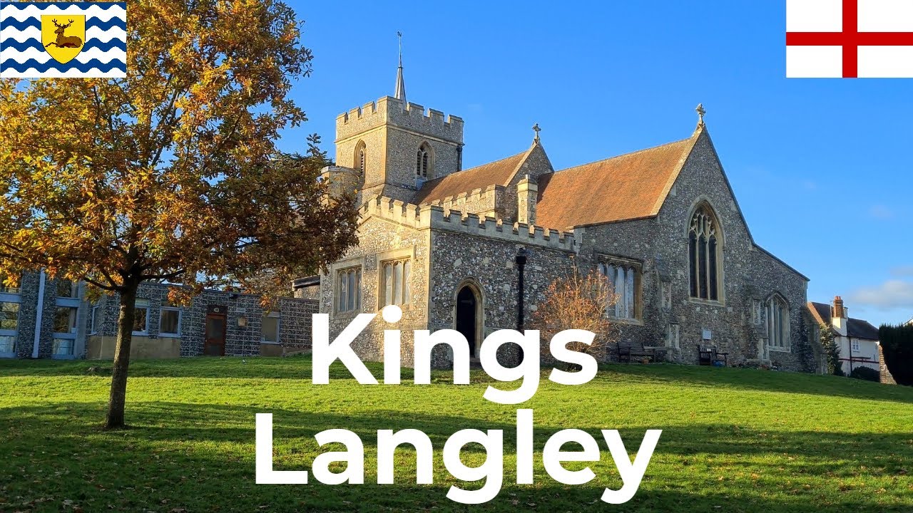
Kings Langley | Hertfordshire | England | UK | Europe | 25/11/2021 | Village Walk
Автор: Walk Through Time
Загружено: 2021-11-30
Просмотров: 2650
Описание:
Date: Thursday 25/11/2021
Location: Kings Langley
Coordinates: 51.71° N
00.45° W
Population: 5,500
Temperature: 7°C
Start Time: 13:50 GMT
Information bars at the bottom of the screen:
Temperature (Degrees Celsius)
Elevation/Height above sea level (Metres)
Road/Street
Latitude, Longitude. In the search box of an app, enter these coordinates. This will take you to the exact location.
Apps used: My Elevation
Google Earth
Websites used: https://weatherspark.com/ - Climate data
https://www.ons.gov.uk/ - Life expectancy data
00:00 - Globe Into
00:22 - All Saints' Church
06:38 - Watford Road/A4251
09:09 - High Street/A4251
13:22 - The Nap
15:24 - Hempstead Road/A4251
17:37 - High Street/A4251
Повторяем попытку...
Доступные форматы для скачивания:
Скачать видео
-
Информация по загрузке:


![10 ЛУЧШИХ МЕСТ ФРАНЦИИ, КОТОРЫЕ НУЖНО УВИДЕТЬ В ЖИЗНИ [РЕЙТИНГ] - ФРАНЦИЯ 2025](https://imager.clipsaver.ru/AC9b41j_J5U/max.jpg)


![25 ЛУЧШИХ МЕСТ ГЕРМАНИИ [РЕЙТИНГ] - Германия 2025 - Не только Берлин и Мюнхен](https://imager.clipsaver.ru/Lfk15cA2EOc/max.jpg)