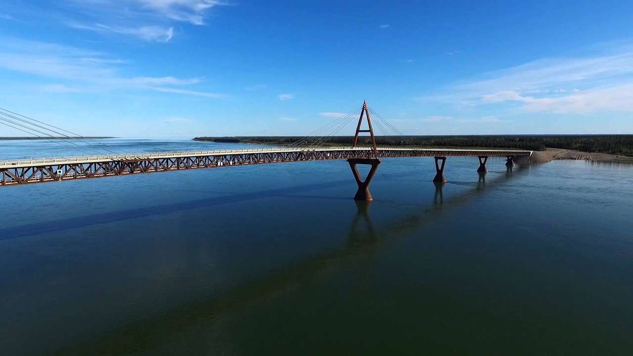
Aerial view of Deh Cho Bridge - Fort Providence Northwest Territories Canada
Автор: YellowKnife NWT
Загружено: 2015-08-19
Просмотров: 3858
Описание:
The Deh Cho Bridge is a 1.1 km (0.68 mi) long bridge across a 1.6 km (0.99 mi) span of the Mackenzie River on Highway 3 near Fort Providence, Northwest Territories, Canada. Construction began in 2008 and was expected to be completed in 2010 but faced delays due to technical and financial difficulties. The bridge officially opened to traffic on November 30, 2012.The bridge replaced the prior ferry/ice bridge combination used for river crossing, replacing MV Merv Hardie, the ferry in operation at the time of opening.
Deh Cho is the Dene name for the Mackenzie River. - www.Wikipedia.com
Opened: November 30, 2012
Total length: 1,100 m
Longest span: 190 m
Body of water: Mackenzie River
Location: Fort Providence
Bridge type: Truss bridge, Cable-stayed bridge
Tags: Aerial Photography Truss Bridge Cabled Stayed Bridge DJI Phantom 3 2 1 Drone UAV Scenic High Definition Camera 4k
Aerial Video UAV Drone DJI Phantom 1 2 3 3DR Solo Tarot Ironman 4K Camera Resolution Yuneec Typhon
Повторяем попытку...
Доступные форматы для скачивания:
Скачать видео
-
Информация по загрузке:


